 Dominican Republic Google Maps and Facts
Map of Dominican Republic ⇣ | Google Maps of Dominican Republic ⇣ | All Places in Dominican Republic ⇣
Welcome to the Google Maps of Dominican Republic (DO) and the comprehensive location list for this country. World Route Planner, together with its detailed Dominican Republic page, turns Google Maps Sightseeing into a meaningful experience! Our extensive destination gazetteer, coupled with Driving Directions to Dominican Republic, allows you to explore Dominican Republic through detailed satellite imagery and street views—fast, free, and easier than ever before.
Browse through the list of administrative regions in Dominican Republic, navigate through these regions to find a place of interest, and book your hotel with the Best Price Guarantee! Your journey through Dominican Republic via Google Satellite Map Sightseeing and Street View starts here.
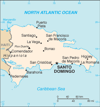
Dominican Republic Google Maps
To activate Street View on any city of Dominican Republic, drag above the Zoom feature the yellow little man in the map.
Facts about Dominican Republic
| Administrative divisions: | 31 provinces (provincias , singular - provincia) and 1 district* (distrito); Azua , Bahoruco , Barahona , Dajabon , Distrito Nacional* , Duarte , El Seibo , Elias Pina , Espaillat , Hato Mayor , Independencia , La Altagracia , La Romana , La Vega , Maria Trinidad Sanchez , Monsenor Nouel , Monte Cristi , Monte Plata , Pedernales , Peravia , Puerto Plata , Salcedo , Samana , San Cristobal , San Jose de Ocoa , San Juan , San Pedro de Macoris , Sanchez Ramirez , Santiago , Santiago Rodriguez , Santo Domingo , Valverde |
| Area: | total: 48 ,730 sq km land: 48 ,380 sq km water: 350 sq km |
| Background: | Explored and claimed by Christopher COLUMBUS on his first voyage in 1492 , the island of Hispaniola became a springboard for Spanish conquest of the Caribbean and the American mainland. In 1697 , Spain recognized French dominion over the western third of the island , which in 1804 became Haiti. The remainder of the island , by then known as Santo Domingo , sought to gain its own independence in 1821 , but was conquered and ruled by the Haitians for 22 years; it finally attained independence as the Dominican Republic in 1844. In 1861 , the Dominicans voluntarily returned to the Spanish Empire , but two years later they launched a war that restored independence in 1865. A legacy of unsettled , mostly non-representative rule followed , capped by the dictatorship of Rafael Leonidas TRUJILLO from 1930-61. Juan BOSCH was elected president in 1962 , but was deposed in a military coup in 1963. In 1965 , the United States led an intervention in the midst of a civil war sparked by an uprising to restore BOSCH. In 1966 , Joaquin BALAGUER defeated BOSCH in an election to become president. BALAGUER maintained a tight grip on power for most of the next 30 years when international reaction to flawed elections forced him to curtail his term in 1996. Since then , regular competitive elections have been held in which opposition candidates have won the presidency. Former President (1996-2000) Leonel FERNANDEZ Reyna won election to a second term in 2004 following a constitutional amendment allowing presidents to serve more than one term. |
| Flag description: | a centered white cross that extends to the edges divides the flag into four rectangles - the top ones are blue (hoist side) and red , and the bottom ones are red (hoist side) and blue; a small coat of arms featuring a shield supported by an olive branch (left) and a palm branch (right) is at the center of the cross; above the shield a blue ribbon displays the motto , DIOS , PATRIA , LIBERTAD (God , Fatherland , Liberty) , and below the shield , REPUBLICA DOMINICANA appears on a red ribbon |
| Capital: | name: Santo Domingo geographic coordinates: 18 28 N , 69 54 W time difference: UTC-4 (1 hour ahead of Washington , DC during Standard Time) |
| Climate: | tropical maritime; little seasonal temperature variation; seasonal variation in rainfall |
| Currency code: | Dominican peso (DOP) |
| Ethnic groups: | mixed 73% , white 16% , black 11% |
| Geographic coordinates: | 19 00 N , 70 40 W |
| Geography note: | shares island of Hispaniola with Haiti |
| Government type: | democratic republic |
| Imports partners: | US 44.8% , Venezuela 7.9% , Colombia 6.6% , Mexico 5.9% (2007) |
| Internet country code: | .do |
| Land boundaries: | 1 ,288 km |
| Neighbouring countries: | total: 360 km border countries: Haiti 360 km |
| Languages: | Spanish |
| Location: | Caribbean , eastern two-thirds of the island of Hispaniola , between the Caribbean Sea and the North Atlantic Ocean , east of Haiti |
| Map references: | Central America and the Caribbean |
| National holiday: | Independence Day , 27 February (1844) |
| Nationality: | noun: Dominican(s) adjective: Dominican |
| Natural hazards: | lies in the middle of the hurricane belt and subject to severe storms from June to October; occasional flooding; periodic droughts |
| Population: | 9 ,507 ,133 (July 2008 est.) |
| Religions: | Roman Catholic 95% , other 5% |
| Terrain: | rugged highlands and mountains with fertile valleys interspersed |
| Unemployment rate: | 15.6% (2007 est.) |
Capital of Dominican Republic
Santo Domingo (click to view Santo Domingo map)
Places in Dominican Republic
Browse the most comprehensive and up-to-date online directory of administrative regions and Street Views in Dominican Republic. Our listings are organized alphabetically, starting from level 1 regions and progressing through to level 2 and eventually level 3 regions, ensuring you can easily navigate and find specific areas of interest.
Agua de Limón city Google map
Agua del Rey city Google map
Agua Dulce city Google map
Aguacate city Google map
Ahorca Los Perros city Google map
Amor de Dios city Google map
Andrés city Google map
Angelito city Google map
Apolinar city Google map
Arabia city Google map
Arenazo city Google map
Arenoso city Google map
Arroyo Blanco city Google map
Arroyo Caña city Google map
Arroyo Cano city Google map
Arroyo Chiquito city Google map
Arroyo de Pedro city Google map
Arroyo del Café city Google map
Arroyo Frío city Google map
Arroyo Hondo city Google map
Arroyo Hondo city Google map
Arroyo Indio city Google map
Arroyo La Angostura city Google map
Arroyo Manteca city Google map
Arroyo Mina city Google map
Arroyo Mingo city Google map
Arroyo Prieto city Google map
Arroyo Salado city Google map
Arroyo Salado city Google map
Arroyo Seco city Google map
Aserradero Santa Rosa city Google map
Azua Province (250 google map locations)
Bañadero city Google map
Baní city Google map
Banilejo city Google map
Baoruco Province (111 google map locations)
Barahona Province (164 google map locations)
Barrio María Auxiliadora city Google map
Barrio Mejoraminto Social city Google map
Barrio Obrero city Google map
Batey Guanuma city Google map
Batey La Culata city Google map
Bayona city Google map
Bella Vista city Google map
Bienvenido city Google map
Boca Canasta city Google map
Boca de Mahoma city Google map
Boca del Caño city Google map
Buena Vista city Google map
Buenas Noches city Google map
Buenos Aires city Google map
Caballona city Google map
Cabeza de Toro city Google map
Cabo Caina city Google map
Cabreto city Google map
Calabaza city Google map
Calderón city Google map
Calero city Google map
Caminero city Google map
Cañada de Manacla city Google map
Cañada Grande city Google map
Cañada Honda city Google map
Cañada Mala city Google map
Cañada Nueva city Google map
Cañada Rincón city Google map
Cañafistol city Google map
Cancino city Google map
Cancino Adentro city Google map
Capotillo city Google map
Carlos Guerra city Google map
Carmona city Google map
Castaño city Google map
Castillo city Google map
Catalina city Google map
Cazuela city Google map
Cercadillo city Google map
Cerro Prieto city Google map
Chempén city Google map
Ciudad Nueva city Google map
Colonia Agrícola city Google map
Comején city Google map
Corbanal city Google map
Córcoba city Google map
Costa Verde city Google map
Cristo Rey city Google map
Cristóbal city Google map
Cruce de Cuenca city Google map
Cruz de Marcos city Google map
Cuenca city Google map
Cueva de la Cotorra city Google map
Cuevas city Google map
Dajabón Province (114 google map locations)
Derrico Blanco city Google map
Derrumbadero de Mahoma city Google map
Derrumbado city Google map
Desecho Largo city Google map
Domingo Frío city Google map
Don Gregorio city Google map
Duarte Province (278 google map locations)
Duquesa city Google map
El Abey city Google map
El Agua city Google map
El Aguacate city Google map
El Ají city Google map
El Algibe city Google map
El Algodonal city Google map
El Alto city Google map
El Amarradero city Google map
El Ancón city Google map
El Añil city Google map
El Bañadero city Google map
El Banco city Google map
El Barrero city Google map
El Barro city Google map
El Bejucal city Google map
El Bonito city Google map
El Buey city Google map
El Cacheo city Google map
El Cachimbo city Google map
El Cachón city Google map
El Cachón city Google map
El Café city Google map
El Caimito city Google map
El Cajón city Google map
El Cajuilito city Google map
El Caliche city Google map
El Camarón city Google map
El Canal city Google map
El Cañaveral city Google map
El Candongo city Google map
El Capá city Google map
El Carrao city Google map
El Carretón city Google map
El Catalán city Google map
El Centro city Google map
El Cercado city Google map
El Chaparral city Google map
El Chifle city Google map
El Coco de Pedro Brand city Google map
El Cocuyo city Google map
El Convento city Google map
El Copado city Google map
El Corbanal city Google map
El Cruce city Google map
El Cruce de Ocoa city Google map
El Cuatro city Google map
El Dajao city Google map
El Derrico city Google map
El Descansadero city Google map
El Desecho city Google map
El Embalsadero city Google map
El Ensanchito city Google map
El Fao city Google map
El Fundo city Google map
El Garrote city Google map
El Guayabo city Google map
El Guazabaral city Google map
El Higo city Google map
El Higüerito city Google map
El Hoyito city Google map
El Hoyo city Google map
El Jengibre city Google map
El Jobito city Google map
El Jobo city Google map
El Jobo de Mendoza city Google map
El Jobo de Suardí city Google map
El Limón city Google map
El Limonal city Google map
El Llano city Google map
El Loasa city Google map
El Mamey city Google map
El Mamón city Google map
El Manielito city Google map
El Matadero city Google map
El Mochito city Google map
El Mogote city Google map
El Montazo city Google map
El Naranjal city Google map
El Naranjo city Google map
El Ojo de Agua city Google map
El Palmar city Google map
El Paredón city Google map
El Peje city Google map
El Perico city Google map
El Pie de la Bija city Google map
El Pie de la Loma city Google map
El Pinar city Google map
El Pinar Grande city Google map
El Plan de Jigüey city Google map
El Puente city Google map
El Puerto city Google map
El Recodo city Google map
El Retiro city Google map
El Rifle city Google map
El Riíto city Google map
El Rincón city Google map
El Rosalito city Google map
El Salto city Google map
El Seíbo Province (337 google map locations)
El Seis city Google map
El Sillón city Google map
El Sordo city Google map
El Tamarindo city Google map
El Tapete city Google map
El Toro city Google map
El Viso city Google map
El Voladero city Google map
El Yayal city Google map
Elías Piña Province (204 google map locations)
Engombe city Google map
Enjuagador city Google map
Ensanche Alma Rosa city Google map
Ensanche Bella Vista city Google map
Ensanche Independencia city Google map
Ensanche La Esperanza city Google map
Ensanche La Fe city Google map
Ensanche Los Minas city Google map
Ensanche Lugo city Google map
Ensanche Luperón city Google map
Ensanche Ozama city Google map
Ensanche Piantini city Google map
Ensanche Presidente Espaillat city Google map
Ensanche Quisqueya city Google map
Ensanche Savica de Mendoza city Google map
Ensanche Villa Faro city Google map
Ensanche Vista Alegre city Google map
Escondido city Google map
Espaillat Province (196 google map locations)
Estorga city Google map
Ferragú city Google map
Ferrand city Google map
Florencio city Google map
Frasquito Gómez city Google map
Fundación city Google map
Fundación de Peravia city Google map
Fundación de Sabana Buey city Google map
Galá city Google map
Galeón city Google map
Gascue city Google map
Gran Diablo city Google map
Guanamonton city Google map
Guaricano city Google map
Guerra city Google map
Guibia city Google map
Hacienda Estrella city Google map
Hacienda la Estrella city Google map
Haina city Google map
Haina Arriba city Google map
Hainamosa city Google map
Hanaclita city Google map
Hatillo city Google map
Hato de Yacó city Google map
Hato Mayor Province (278 google map locations)
Hato Nuevo city Google map
Hato Viejo city Google map
Herrera city Google map
Higuamo city Google map
Higüero city Google map
Higüerotes city Google map
Higüey city Google map
Hojas Anchas city Google map
Honduras city Google map
Honduras city Google map
Hornillo city Google map
Hoyo Nuevo city Google map
Hoyo Oscuro city Google map
Iguana city Google map
Independencia Province (85 google map locations)
Isabel Arriba city Google map
Isabelita city Google map
Ismael Jiménez city Google map
Jacagua city Google map
Jigüey city Google map
Juan de Sena city Google map
Juan Grande city Google map
Juan López city Google map
Juan Luis city Google map
Juan Tomás city Google map
Juanajico city Google map
Jubey city Google map
Junumucú city Google map
Kilómetro Once city Google map
La Agüita city Google map
La Agustina city Google map
La Alianza city Google map
La Altagracia Province (269 google map locations)
La Angostura city Google map
La Atravesía city Google map
La Baría city Google map
La Barquita de Santa Cruz city Google map
La Batata city Google map
La Bejuquera city Google map
La Berroa city Google map
La Bija city Google map
La Boca de Cazuela city Google map
La Boca de Cazuelita city Google map
La Bomba city Google map
La Boruga city Google map
La Botella city Google map
La Brusca city Google map
La Cabilma city Google map
La Cabirma city Google map
La Cana city Google map
La Cañita city Google map
La Caoba city Google map
La Caridad city Google map
La Catalina city Google map
La Ceiba city Google map
La Ciénaga city Google map
La Ciénaga al Medio city Google map
La Cienaguita city Google map
La Colonia city Google map
La Cortadera city Google map
La Cruz city Google map
La Cruz de Hierro city Google map
La Cruz de Mendoza city Google map
La Cruz de Santana city Google map
La Cuchilla city Google map
La Cuchilla de Pío city Google map
La Cuesta city Google map
La Cueva city Google map
La Culata city Google map
La Culebra city Google map
La Demajagua city Google map
La Esperanza city Google map
La Esperilla city Google map
La Estancia city Google map
La Estrechura city Google map
La Estrella city Google map
La Faría city Google map
La Filipina city Google map
La Francia city Google map
La Fuente city Google map
La Gata city Google map
La Golondrina city Google map
La Grama city Google map
La Granja city Google map
La Grúa city Google map
La Guabina city Google map
La Higuera city Google map
La Higuerita city Google map
La Hondonada city Google map
La Horma city Google map
La Infinita city Google map
La Isabela city Google map
La Isleta city Google map
La Jagua city Google map
La Jaiba city Google map
La Javilla city Google map
La Jina city Google map
La Julia city Google map
La Laguna city Google map
La Lagunita city Google map
La Lechuga city Google map
La Lechuza city Google map
La Lomita city Google map
La Majagua city Google map
La Mala Vuelta city Google map
La Malagueta city Google map
La Malanga city Google map
La Malena city Google map
La Malenita city Google map
La Manacla city Google map
La Manaclita city Google map
La Marca city Google map
La Matica city Google map
La Mesa de los Negros city Google map
La Mesa de Pino city Google map
La Monteadita city Google map
La Montería city Google map
La Montosa city Google map
La Muelle city Google map
La Noria city Google map
La Nuez city Google map
La Palma city Google map
La Palmilla city Google map
La Paloma city Google map
La Paz city Google map
La Peñita city Google map
La Perdiz city Google map
La Piedra city Google map
La Piña city Google map
La Placeta city Google map
La Pluma city Google map
La Pomarrosa city Google map
La Primavera city Google map
La Primavera city Google map
La Pringamosa city Google map
La Puerca city Google map
La Rafaela city Google map
La Rinconada city Google map
La Romana Province (88 google map locations)
La Rusia city Google map
La Sabana city Google map
La Sabana del Viato city Google map
La Sabaneta city Google map
La Telanza city Google map
La Ternera city Google map
La Toronja city Google map
La Travesía city Google map
La Trocha city Google map
La Tumba city Google map
La Ureña city Google map
La Vega Province (400 google map locations)
La Venta city Google map
La Vereda city Google map
La Vereda Nueva city Google map
La Vigía city Google map
La Viva city Google map
La Yautía city Google map
La Yayita city Google map
La Yerba Buena city Google map
La Yuca city Google map
La Zurza city Google map
Laguna Seca city Google map
Las Auyamas city Google map
Las Avispas city Google map
Las Barías city Google map
Las Bocaínas city Google map
Las Calderas city Google map
Las Cañitas city Google map
Las Caobas city Google map
Las Carreras city Google map
Las Garzas city Google map
Las Goyas city Google map
Las Lagunetas city Google map
Las Nueces city Google map
Las Palmas city Google map
Las Palmitas city Google map
Las Parras city Google map
Las Piedras Malas city Google map
Las Salinas city Google map
Las Tablas city Google map
Las Tunas city Google map
Las Yaguas city Google map
Las Yayas city Google map
Lechería city Google map
Licey city Google map
Limón de Catarey city Google map
Limonal city Google map
Loma de los Helechos city Google map
Los Aguacates city Google map
Los Anones city Google map
Los Arroyitos city Google map
Los Arroyos city Google map
Los Báez city Google map
Los Bancos de Arena city Google map
Los Blancos city Google map
Los Botados city Google map
Los Brazos city Google map
Los Caimitos city Google map
Los Cajones city Google map
Los Calabacitos city Google map
Los Callejones city Google map
Los Capacitos city Google map
Los Casabes city Google map
Los Castillos city Google map
Los Cateyes city Google map
Los Cedros city Google map
Los Chupaderos city Google map
Los Cimarrones city Google map
Los Cocos city Google map
Los Córbanos city Google map
Los Corozos city Google map
Los Dajaos city Google map
Los Dos Ríos city Google map
Los Fogoncitos city Google map
Los Fondos city Google map
Los Frailes city Google map
Los Gajos city Google map
Los Ganchos city Google map
Los Genaros city Google map
Los Golondrinos city Google map
Los Grillos city Google map
Los Guayabos city Google map
Los Helechos city Google map
Los Jobos city Google map
Los Jobos Arriba city Google map
Los Jobos de Matúa city Google map
Los Limoncillos city Google map
Los Limones city Google map
Los Llanos city Google map
Los Macos city Google map
Los Mameyes city Google map
Los Manaclares city Google map
Los Marranos city Google map
Los Martínez city Google map
Los Mayales city Google map
Los Minas city Google map
Los Montes Quemados city Google map
Los Morenos city Google map
Los Morones city Google map
Los Naranjales city Google map
Los Naranjos city Google map
Los Negros city Google map
Los Palmaritos city Google map
Los Peñas city Google map
Los Peralejos city Google map
Los Pilones city Google map
Los Pinos city Google map
Los Pocitos city Google map
Los Pozos city Google map
Los Prados city Google map
Los Quemados city Google map
Los Ramones city Google map
Los Ranchitos city Google map
Los Ranchos city Google map
Los Rinconcitos city Google map
Los Rincones city Google map
Los Tocones city Google map
Los Tramojos city Google map
Los Tres Brazos city Google map
Los Tres Ojos de Agua city Google map
Los Urbanos city Google map
Los Yaguarizos city Google map
Mahoma city Google map
Majagüita city Google map
Mal Nombre city Google map
Mala Vuelta city Google map
Mamey city Google map
Mamey Macho city Google map
Manaclar city Google map
Mancebo city Google map
Mancha Nueva city Google map
Mandinga city Google map
Manganagua city Google map
Manganagua city Google map
Manoguayabo city Google map
Manzano city Google map
María Trinidad Sánchez Province (227 google map locations)
Maricao city Google map
Maricarmen city Google map
Marmolejos city Google map
Marucho city Google map
Mata de Becerro city Google map
Mata de Piedra city Google map
Mata de San Juan city Google map
Mata Gorda city Google map
Mata Hambre city Google map
Mata los Indios city Google map
Mata Mamón city Google map
Mata Palma city Google map
Mata Vaca city Google map
Matanzas city Google map
Media Cara city Google map
Mellizo city Google map
Méndez city Google map
Mendoza city Google map
Miranda city Google map
Mojarra city Google map
Monseñor Nouel Province (159 google map locations)
Monte Adentro city Google map
Monte Bonito city Google map
Monte Conuco city Google map
Monte Cristi Province (209 google map locations)
Monte Grande city Google map
Monte Higüero city Google map
Monte Llano city Google map
Monte Maniel city Google map
Monte Negro city Google map
Monte Plata Province (449 google map locations)
Monteada de Javier city Google map
Mosquitería city Google map
Naiboa city Google map
Naranjal Abajo city Google map
Naranjal Arriba city Google map
Naranjo city Google map
Naranjo Dulce city Google map
National District (1 google map locations)
Nizao city Google map
Ojo de Agua city Google map
Palabe city Google map
Palamar city Google map
Palmarito city Google map
Palmarjito city Google map
Palo Blanco city Google map
Palo Bonito city Google map
Palo de Caja city Google map
Palo de la Higuera city Google map
Pantaleón city Google map
Paredón city Google map
Parra city Google map
Paso Hondo city Google map
Paya city Google map
Pedernales Province (24 google map locations)
Pedregal city Google map
Pelegrino city Google map
Peralejo city Google map
Perantuén city Google map
Peravia city Google map
Peravia Province city Google map
Pie de La Grama city Google map
Piedra Gorda city Google map
Pino Mocho city Google map
Pío city Google map
Piragua city Google map
Pizarrete city Google map
Por Quién Llora city Google map
Provincia de San José de Ocoa city Google map
Provincia de Santo Domingo (11 google map locations)
Pueblo Nuevo city Google map
Puerto Plata Province (421 google map locations)
Punta city Google map
Quita Pena city Google map
Quita Sueño city Google map
Rancho Agustín city Google map
Rancho Arriba city Google map
Rancho de Chale city Google map
Rancho de Francisco city Google map
Rancho de Matos city Google map
Reparto Esther Rosario city Google map
Reparto Isabelita city Google map
Reventón city Google map
Rincón de Yacó city Google map
Rincón del Pino city Google map
Río Abajo city Google map
Río Arriba city Google map
Roblegar city Google map
Sabana Abajo city Google map
Sabana Buey city Google map
Sabana Chiquita city Google map
Sabana de la Paciencia city Google map
Sabana en Medio city Google map
Sabana Grande city Google map
Sabana Guao city Google map
Sabana Indio city Google map
Sabana Jovero city Google map
Sabana Larga city Google map
Sabana Larga de Ocoa city Google map
Sabana Mina city Google map
Sabana Perdida city Google map
Sabaneta city Google map
Salamanca city Google map
Salcedo Province (105 google map locations)
Samaná Province (152 google map locations)
San Antonio city Google map
San Bartolo city Google map
San Carlos city Google map
San Cristóbal Province (313 google map locations)
San Diego city Google map
San Felipe city Google map
San Isidro city Google map
San Joaquín city Google map
San José city Google map
San José de Mendoza city Google map
San José de Ocoa city Google map
San Juan Province (367 google map locations)
San Martín de Porres city Google map
San Mateo city Google map
San Miguel city Google map
San Pedro de Macorís Province (268 google map locations)
Sánchez Ramírez Province (232 google map locations)
Sanguino city Google map
Sans Souci city Google map
Santa Cruz city Google map
Santa Cruz city Google map
Santa Rosa city Google map
Santana city Google map
Santiago Province (488 google map locations)
Santiago Rodríguez Province (225 google map locations)
Sauldí city Google map
Saviñón city Google map
Sesteadero del Toro city Google map
Sierra Prieta city Google map
Simón Bolivar city Google map
Simonico city Google map
Sombrero city Google map
Sonador city Google map
Suardí city Google map
Tallota city Google map
Tamarindo del Norte city Google map
Tatón city Google map
Tentación city Google map
Tierra Blanca city Google map
Timbeque city Google map
Tosa city Google map
Totoñoso city Google map
Trapiche city Google map
Tumbaca city Google map
Valdesia city Google map
Valentín city Google map
Valiente city Google map
Valverde Province (102 google map locations)
Varía city Google map
Victorino city Google map
Villa Consuelo city Google map
Villa Duarte city Google map
Villa Francisca city Google map
Villa Güera city Google map
Villa Luisa city Google map
Villa María city Google map
Villa Mella city Google map
Villas Agrícolas Número Dos city Google map
Villas Agrícolas Número Uno city Google map
Vuelta de La Barranca city Google map
Vuelta Grande city Google map
Yacó city Google map
Yaguaza city Google map
Yerba Buena city Google map
Random cities in Dominican Republic
Santo Domingo, the capital city of Dominican Republic.San Rafael
Lázaro
La Cañita
Los Fogones
Batey Aletón
Coto
Los Bejucos
Los Mapolos
La Playa
La Matica
El Vallecito
La Berroa
Jagüey
El Toro
La Trinchera
Las Uvitas
El Gorro
Lavapié
Flor
Link to Dominican Republic Google Maps page
The map of Dominican Republic has already attracted 6805 views. If you wish to embed our comprehensive Dominican Republic map on your site, we offer an easy solution. This map includes free access to Google Maps, gazetteer search, detailed country and city maps, Street View, and essential facts, all ready to enhance your website. To use it, simply copy and paste the provided HTML code into your webpage's source code. We appreciate every link back to our Maps and Driving Directions. Thank you for your support!
| Text link to: Dominican Republic map and facts page |
This Dominican Republic map is intended solely for informational purposes. No representations or warranties are made concerning its accuracy or reliability. Users assume all risks associated with the use of Google Maps and Google Driving Directions. World Route Planner is not liable for any losses or delays that may occur from using this free Dominican Republic map.