 Republic of El Salvador Google Maps and Facts
Welcome to the Google Maps of El Salvador (SV) and the comprehensive location list for this country. World Route Planner, together with its detailed El Salvador page, turns Google Maps Sightseeing into a meaningful experience! Our extensive destination gazetteer, coupled with Driving Directions to El Salvador, allows you to explore El Salvador through detailed satellite imagery and street views—fast, free, and easier than ever before.
Browse through the list of administrative regions in El Salvador, navigate through these regions to find a place of interest, and book your hotel with the Best Price Guarantee! Your journey through El Salvador via Google Satellite Map Sightseeing and Street View starts here.
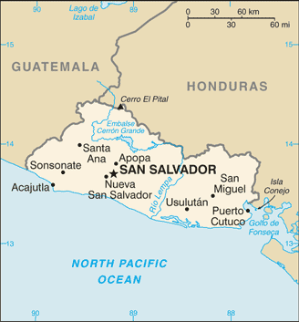
El Salvador Google Maps
To activate Street View on any city of El Salvador, drag above the Zoom feature the yellow little man in the map.
Facts about El Salvador
| Administrative divisions: | 14 departments (departamentos , singular - departamento); Ahuachapan , Cabanas , Chalatenango , Cuscatlan , La Libertad , La Paz , La Union , Morazan , San Miguel , San Salvador , San Vicente , Santa Ana , Sonsonate , Usulutan |
| Area: | total: 21 ,040 sq km land: 20 ,720 sq km water: 320 sq km |
| Background: | El Salvador achieved independence from Spain in 1821 and from the Central American Federation in 1839. A 12-year civil war , which cost about 75 ,000 lives , was brought to a close in 1992 when the government and leftist rebels signed a treaty that provided for military and political reforms. |
| Flag description: | three equal horizontal bands of blue (top) , white , and blue with the national coat of arms centered in the white band; the coat of arms features a round emblem encircled by the words REPUBLICA DE EL SALVADOR EN LA AMERICA CENTRAL; similar to the flag of Nicaragua , which has a different coat of arms centered in the white band - it features a triangle encircled by the words REPUBLICA DE NICARAGUA on top and AMERICA CENTRAL on the bottom; also similar to the flag of Honduras , which has five blue stars arranged in an X pattern centered in the white band |
| Capital: | name: San Salvador geographic coordinates: 13 42 N , 89 12 W time difference: UTC-6 (1 hour behind Washington , DC during Standard Time) |
| Climate: | tropical; rainy season (May to October); dry season (November to April); tropical on coast; temperate in uplands |
| Currency code: | US dollar (USD) |
| Ethnic groups: | mestizo 90% , white 9% , Amerindian 1% |
| Geographic coordinates: | 13 50 N , 88 55 W |
| Geography note: | smallest Central American country and only one without a coastline on Caribbean Sea |
| Government type: | republic |
| Imports partners: | US 31.7% , Guatemala 10.6% , Mexico 8.5% , China 4.8% (2007) |
| Internet country code: | .sv |
| Land boundaries: | 307 km |
| Neighbouring countries: | total: 545 km border countries: Guatemala 203 km , Honduras 342 km |
| Languages: | Spanish , Nahua (among some Amerindians) |
| Location: | Central America , bordering the North Pacific Ocean , between Guatemala and Honduras |
| Map references: | Central America and the Caribbean |
| National holiday: | Independence Day , 15 September (1821) |
| Nationality: | noun: Salvadoran(s) adjective: Salvadoran |
| Natural hazards: | known as the Land of Volcanoes; frequent and sometimes destructive earthquakes and volcanic activity; extremely susceptible to hurricanes |
| Population: | 7 ,066 ,403 (July 2008 est.) |
| Religions: | Roman Catholic 57.1% , Protestant 21.2% , Jehovah's Witnesses 1.9% , Mormon 0.7% , other religions 2.3% , none 16.8% (2003 est.) |
| Terrain: | mostly mountains with narrow coastal belt and central plateau |
| Unemployment rate: | 6.2% official rate; but the economy has much underemployment (2007 est.) |
Capital of Republic of El Salvador
San Salvador (click to view San Salvador map)
Places in El Salvador
Browse the most comprehensive and up-to-date online directory of administrative regions and Street Views in El Salvador. Our listings are organized alphabetically, starting from level 1 regions and progressing through to level 2 and eventually level 3 regions, ensuring you can easily navigate and find specific areas of interest.
Cabañas Department (161 google map locations)
Chalatenango Department (245 google map locations)
Cuscatlán Department (127 google map locations)
La Libertad Department (254 google map locations)
La Paz Department (202 google map locations)
La Unión Department (290 google map locations)
San Miguel Department (362 google map locations)
San Salvador Department (155 google map locations)
San Vicente Department (159 google map locations)
Santa Ana Department (292 google map locations)
Sonsonate Department (172 google map locations)
Usulután Department (286 google map locations)
Random cities in El Salvador
San Salvador, the capital city of El Salvador.San Juan
El Rincón
Colonia San Judas
Cerro El Jiote
San Francisco El Porfiado
El Jobito
La Pinte
Istagua
Buena Vista Arrinconada
El Paraíso
El Platanar
Hacienda Mechotique
Nejapa
El Naranjito
El Pastor
San Sebastián Arriba
Tejutepeque
El Amatal
San Jorge
Link to El Salvador Google Maps page
The map of El Salvador has already attracted 8238 views. If you wish to embed our comprehensive El Salvador map on your site, we offer an easy solution. This map includes free access to Google Maps, gazetteer search, detailed country and city maps, Street View, and essential facts, all ready to enhance your website. To use it, simply copy and paste the provided HTML code into your webpage's source code. We appreciate every link back to our Maps and Driving Directions. Thank you for your support!
| Text link to: El Salvador map and facts page |
This El Salvador map is intended solely for informational purposes. No representations or warranties are made concerning its accuracy or reliability. Users assume all risks associated with the use of Google Maps and Google Driving Directions. World Route Planner is not liable for any losses or delays that may occur from using this free El Salvador map.