 Kingdom of the Netherlands Google Maps and Facts
Welcome to the Google Maps of Netherlands (NL) and the comprehensive location list for this country. World Route Planner, together with its detailed Netherlands page, turns Google Maps Sightseeing into a meaningful experience! Our extensive destination gazetteer, coupled with Driving Directions to Netherlands, allows you to explore Netherlands through detailed satellite imagery and street views—fast, free, and easier than ever before.
Browse through the list of administrative regions in Netherlands, navigate through these regions to find a place of interest, and book your hotel with the Best Price Guarantee! Your journey through Netherlands via Google Satellite Map Sightseeing and Street View starts here.
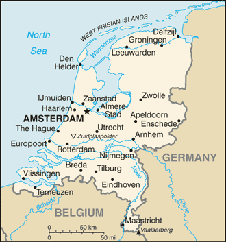
Netherlands Google Maps
To activate Street View on any city of Netherlands, drag above the Zoom feature the yellow little man in the map.
Facts about Netherlands
| Administrative divisions: | 12 provinces (provincies , singular - provincie); Drenthe , Flevoland , Friesland (Fryslan) , Gelderland , Groningen , Limburg , Noord-Brabant (North Brabant) , Noord-Holland (North Holland) , Overijssel , Utrecht , Zeeland (Zealand) , Zuid-Holland (South Holland) |
| Area: | total: 41 ,526 sq km land: 33 ,883 sq km water: 7 ,643 sq km |
| Background: | The Dutch United Provinces declared their independence from Spain in 1579; during the 17th century , they became a leading seafaring and commercial power , with settlements and colonies around the world. After a 20-year French occupation , a Kingdom of the Netherlands was formed in 1815. In 1830 Belgium seceded and formed a separate kingdom. The Netherlands remained neutral in World War I , but suffered invasion and occupation by Germany in World War II. A modern , industrialized nation , the Netherlands is also a large exporter of agricultural products. The country was a founding member of NATO and the EEC (now the EU) , and participated in the introduction of the euro in 1999. |
| Flag description: | three equal horizontal bands of red (top) , white , and blue; similar to the flag of Luxembourg , which uses a lighter blue and is longer; one of the oldest flags in constant use , originating with WILLIAM I , Prince of Orange , in the latter half of the 16th century |
| Capital: | name: Amsterdam geographic coordinates: 52 23 N , 4 54 E time difference: UTC+1 (6 hours ahead of Washington , DC during Standard Time) daylight saving time: +1hr , begins last Sunday in March; ends last Sunday in October note: The Hague is the seat of government; time descriptions apply to the continental Netherlands only , not to the Caribbean components |
| Climate: | temperate; marine; cool summers and mild winters |
| Currency code: | euro (EUR) |
| Ethnic groups: | Dutch 80.7% , EU 5% , Indonesian 2.4% , Turkish 2.2% , Surinamese 2% , Moroccan 2% , Netherlands Antilles & Aruba 0.8% , other 4.8% (2008 est.) |
| Geographic coordinates: | 52 30 N , 5 45 E |
| Geography note: | located at mouths of three major European rivers (Rhine , Maas or Meuse , and Schelde) |
| Government type: | constitutional monarchy |
| Imports partners: | Germany 17.6% , China 10.5% , Belgium 9.3% , US 7.3% , UK 5.8% , Russia 5% , France 4.4% (2007) |
| Internet country code: | .nl |
| Land boundaries: | 451 km |
| Neighbouring countries: | total: 1 ,027 km border countries: Belgium 450 km , Germany 577 km |
| Languages: | Dutch (official) , Frisian (official) |
| Location: | Western Europe , bordering the North Sea , between Belgium and Germany |
| Map references: | Europe |
| National holiday: | Queen's Day (Birthday of Queen-Mother JULIANA and accession to the throne of her oldest daughter BEATRIX) , 30 April (1909 and 1980) |
| Nationality: | noun: Dutchman(men) , Dutchwoman(women) adjective: Dutch |
| Natural hazards: | flooding |
| Population: | 16 ,645 ,313 (July 2008 est.) |
| Religions: | Roman Catholic 30% , Dutch Reformed 11% , Calvinist 6% , other Protestant 3% , Muslim 5.8% , other 2.2% , none 42% (2006) |
| Terrain: | mostly coastal lowland and reclaimed land (polders); some hills in southeast |
| Unemployment rate: | 4.6% (2007 est.) |
Capital of Kingdom of the Netherlands
's-Gravenhage (click to view 's-Gravenhage map)
Places in Netherlands
Browse the most comprehensive and up-to-date online directory of administrative regions and Street Views in Netherlands. Our listings are organized alphabetically, starting from level 1 regions and progressing through to level 2 and eventually level 3 regions, ensuring you can easily navigate and find specific areas of interest.
Flevoland Province (26 google map locations)
Friesland Province (730 google map locations)
Gelderland Province (847 google map locations)
Groningen Province (577 google map locations)
Limburg Province (797 google map locations)
North Holland Province (525 google map locations)
Overijssel Province (519 google map locations)
South Holland Province (577 google map locations)
Utrecht Province (266 google map locations)
Zeeland Province (354 google map locations)
Random cities in Netherlands
's-Gravenhage, the capital city of Netherlands.Eibergen
Warmenhuizen
Gramsbergen
Peest
Lamper
De Baest
Magistraatwijk
Erm
Heike
Goirle
Soest-Zuid
Lubbinge
Varkenshoek
Makkum
Boornzwaag
Doornenburg
Hollenberg
Ullingen
Haghorst
Link to Netherlands Google Maps page
The map of Netherlands has already attracted 24204 views. If you wish to embed our comprehensive Netherlands map on your site, we offer an easy solution. This map includes free access to Google Maps, gazetteer search, detailed country and city maps, Street View, and essential facts, all ready to enhance your website. To use it, simply copy and paste the provided HTML code into your webpage's source code. We appreciate every link back to our Maps and Driving Directions. Thank you for your support!
| Text link to: Netherlands map and facts page |
This Netherlands map is intended solely for informational purposes. No representations or warranties are made concerning its accuracy or reliability. Users assume all risks associated with the use of Google Maps and Google Driving Directions. World Route Planner is not liable for any losses or delays that may occur from using this free Netherlands map.