 Republic of Poland Google Maps and Facts
Welcome to the Google Maps of Poland (PL) and the comprehensive location list for this country. World Route Planner, together with its detailed Poland page, turns Google Maps Sightseeing into a meaningful experience! Our extensive destination gazetteer, coupled with Driving Directions to Poland, allows you to explore Poland through detailed satellite imagery and street views—fast, free, and easier than ever before.
Browse through the list of administrative regions in Poland, navigate through these regions to find a place of interest, and book your hotel with the Best Price Guarantee! Your journey through Poland via Google Satellite Map Sightseeing and Street View starts here.
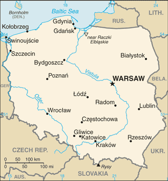
Poland Google Maps
To activate Street View on any city of Poland, drag above the Zoom feature the yellow little man in the map.
Facts about Poland
| Administrative divisions: | 16 provinces (wojewodztwa , singular - wojewodztwo); Dolnoslaskie (Lower Silesia) , Kujawsko-Pomorskie (Kuyavia-Pomerania) , Lodzkie , Lubelskie (Lublin) , Lubuskie (Lubusz) , Malopolskie (Lesser Poland) , Mazowieckie (Masovia) , Opolskie , Podkarpackie (Subcarpathia) , Podlaskie , Pomorskie (Pomerania) , Slaskie (Silesia) , Swietokrzyskie , Warminsko-Mazurskie (Warmia-Masuria) , Wielkopolskie (Greater Poland) , Zachodniopomorskie (West Pomerania) |
| Area: | total: 312 ,679 sq km land: 304 ,459 sq km water: 8 ,220 sq km |
| Background: | Poland is an ancient nation that was conceived near the middle of the 10th century. Its golden age occurred in the 16th century. During the following century , the strengthening of the gentry and internal disorders weakened the nation. In a series of agreements between 1772 and 1795 , Russia , Prussia , and Austria partitioned Poland amongst themselves. Poland regained its independence in 1918 only to be overrun by Germany and the Soviet Union in World War II. It became a Soviet satellite state following the war , but its government was comparatively tolerant and progressive. Labor turmoil in 1980 led to the formation of the independent trade union "Solidarity" that over time became a political force and by 1990 had swept parliamentary elections and the presidency. A "shock therapy" program during the early 1990s enabled the country to transform its economy into one of the most robust in Central Europe , but Poland still faces the lingering challenges of high unemployment , underdeveloped and dilapidated infrastructure , and a poor rural underclass. Solidarity suffered a major defeat in the 2001 parliamentary elections when it failed to elect a single deputy to the lower house of Parliament , and the new leaders of the Solidarity Trade Union subsequently pledged to reduce the Trade Union's political role. Poland joined NATO in 1999 and the European Union in 2004. With its transformation to a democratic , market-oriented country largely completed , Poland is an increasingly active member of Euro-Atlantic organizations. |
| Flag description: | two equal horizontal bands of white (top) and red; similar to the flags of Indonesia and Monaco which are red (top) and white |
| Capital: | name: Warsaw geographic coordinates: 52 15 N , 21 00 E time difference: UTC+1 (6 hours ahead of Washington , DC during Standard Time) daylight saving time: +1hr , begins last Sunday in March; ends last Sunday in October |
| Climate: | temperate with cold , cloudy , moderately severe winters with frequent precipitation; mild summers with frequent showers and thundershowers |
| Currency code: | zloty (PLN) |
| Ethnic groups: | Polish 96.7% , German 0.4% , Belarusian 0.1% , Ukrainian 0.1% , other and unspecified 2.7% (2002 census) |
| Geographic coordinates: | 52 00 N , 20 00 E |
| Geography note: | historically , an area of conflict because of flat terrain and the lack of natural barriers on the North European Plain |
| Government type: | republic |
| Imports partners: | Germany 28.9% , Russia 8.8% , Italy 6.5% , Netherlands 5.6% , France 5.1% , China 4.2% (2007) |
| Internet country code: | .pl |
| Land boundaries: | 440 km |
| Neighbouring countries: | total: 3 ,047 km border countries: Belarus 605 km , Czech Republic 615 km , Germany 456 km , Lithuania 91 km , Russia (Kaliningrad Oblast) 432 km , Slovakia 420 km , Ukraine 428 km |
| Languages: | Polish 97.8% , other and unspecified 2.2% (2002 census) |
| Location: | Central Europe , east of Germany |
| Map references: | Europe |
| National holiday: | Constitution Day , 3 May (1791) |
| Nationality: | noun: Pole(s) adjective: Polish |
| Natural hazards: | flooding |
| Population: | 38 ,500 ,696 (July 2008 est.) |
| Religions: | Roman Catholic 89.8% (about 75% practicing) , Eastern Orthodox 1.3% , Protestant 0.3% , other 0.3% , unspecified 8.3% (2002) |
| Terrain: | mostly flat plain; mountains along southern border |
| Unemployment rate: | 12.8% (2007 est.) |
Capital of Republic of Poland
Warszawa (click to view Warszawa map)
Places in Poland
Browse the most comprehensive and up-to-date online directory of administrative regions and Street Views in Poland. Our listings are organized alphabetically, starting from level 1 regions and progressing through to level 2 and eventually level 3 regions, ensuring you can easily navigate and find specific areas of interest.
Kuyavian-Pomeranian Voivodeship (2177 google map locations)
Lesser Poland Voivodeship (2030 google map locations)
Lower SilesiaN Voivodeship (532 google map locations)
Lublin Voivodeship (2912 google map locations)
Lubusz Voivodeship (253 google map locations)
Masovian Voivodeship (5784 google map locations)
Opole Voivodeship (324 google map locations)
Pomeranian Voivodeship (1401 google map locations)
Silesian Voivodeship (1492 google map locations)
Subcarpathian Voivodeship (1901 google map locations)
Świętokrzyskie Voivodeship (2039 google map locations)
Warmian-Masurian Voivodeship (2445 google map locations)
West Pomeranian Voivodeship (557 google map locations)
Łódź Voivodeship (3434 google map locations)
Random cities in Poland
Warszawa, the capital city of Poland.Rakowice
Potok
Zglechów
Szczepkowskie Żale
Bór Kunowski
Ożumiech
Ciemna Dąbrowa
Cisówka
Krynice
Pruszków
Gardoty
Strzelce Wielkie
Motycz
Gutów
Pietronki
Szast
Niewino Leśne
Huciska
Trześń
Link to Poland Google Maps page
The map of Poland has already attracted 12987 views. If you wish to embed our comprehensive Poland map on your site, we offer an easy solution. This map includes free access to Google Maps, gazetteer search, detailed country and city maps, Street View, and essential facts, all ready to enhance your website. To use it, simply copy and paste the provided HTML code into your webpage's source code. We appreciate every link back to our Maps and Driving Directions. Thank you for your support!
| Text link to: Poland map and facts page |
This Poland map is intended solely for informational purposes. No representations or warranties are made concerning its accuracy or reliability. Users assume all risks associated with the use of Google Maps and Google Driving Directions. World Route Planner is not liable for any losses or delays that may occur from using this free Poland map.