 Territorial Collectivity of Saint Pierre and Miquelon Google Maps and Facts
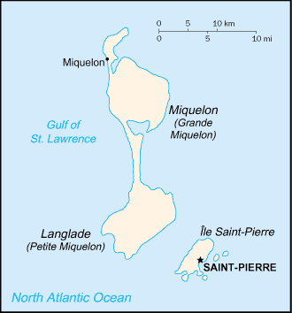
Map of Saint Pierre and Miquelon ⇣ | Google Maps of Saint Pierre and Miquelon ⇣ | All Places in Saint Pierre and Miquelon ⇣
Welcome to the Google Maps of Saint Pierre and Miquelon (PM) and the comprehensive location list for this country. World Route Planner, together with its detailed Saint Pierre and Miquelon page, turns Google Maps Sightseeing into a meaningful experience! Our extensive destination gazetteer, coupled with Driving Directions to Saint Pierre and Miquelon, allows you to explore Saint Pierre and Miquelon through detailed satellite imagery and street views—fast, free, and easier than ever before.
Browse through the list of administrative regions in Saint Pierre and Miquelon, navigate through these regions to find a place of interest, and book your hotel with the Best Price Guarantee! Your journey through Saint Pierre and Miquelon via Google Satellite Map Sightseeing and Street View starts here.
Saint Pierre and Miquelon Google Maps
To activate Street View on any city of Saint Pierre and Miquelon, drag above the Zoom feature the yellow little man in the map.
Facts about Saint Pierre and Miquelon
| Administrative divisions: | none (territorial overseas collectivity of France); note - there are no first-order administrative divisions as defined by the US Government , but there are two communes - Saint Pierre , Miquelon at the second order |
| Area: | total: 242 sq km land: 242 sq km water: 0 sq km note: includes eight small islands in the Saint Pierre and the Miquelon groups |
| Background: | First settled by the French in the early 17th century , the islands represent the sole remaining vestige of France's once vast North American possessions. |
| Flag description: | a yellow sailing ship facing the hoist side rides on a dark blue background with yellow wavy lines under the ship; on the hoist side , a vertical band is divided into three parts: the top part (called ikkurina) is red with a green diagonal cross extending to the corners overlaid by a white cross dividing the rectangle into four sections; the middle part has a white background with an ermine pattern; the third part has a red background with two stylized yellow lions outlined in black , one above the other; these three heraldic arms represent settlement by colonists from the Basque Country (top) , Brittany , and Normandy; the flag of France is used for official occasions |
| Capital: | name: Saint-Pierre geographic coordinates: 46 46 N , 56 11 W time difference: UTC-3 (2 hours ahead of Washington , DC during Standard Time) daylight saving time: +1hr , begins second Sunday in March; ends first Sunday in November |
| Climate: | cold and wet , with much mist and fog; spring and autumn are windy |
| Currency code: | |
| Ethnic groups: | Basques and Bretons (French fishermen) |
| Geographic coordinates: | 46 50 N , 56 20 W |
| Geography note: | vegetation scanty |
| Government type: | NA |
| Imports partners: | France 51.3% , Canada 31.8% , Belgium 4.1% (2006) |
| Internet country code: | .pm |
| Land boundaries: | 120 km |
| Neighbouring countries: | 0 km |
| Languages: | French (official) |
| Location: | Northern North America , islands in the North Atlantic Ocean , south of Newfoundland (Canada) |
| Map references: | North America |
| National holiday: | Bastille Day , 14 July (1789) |
| Nationality: | noun: Frenchman(men) , Frenchwoman(women) adjective: French |
| Natural hazards: | persistent fog throughout the year can be a maritime hazard |
| Population: | 7 ,044 (July 2008 est.) |
| Religions: | Roman Catholic 99% , other 1% |
| Terrain: | mostly barren rock |
| Unemployment rate: | 10.3% (1999) |
Capital of Territorial Collectivity of Saint Pierre and Miquelon
Saint-Pierre (click to view Saint-Pierre map)
Places in Saint Pierre and Miquelon
Browse the most comprehensive and up-to-date online directory of administrative regions and Street Views in Saint Pierre and Miquelon. Our listings are organized alphabetically, starting from level 1 regions and progressing through to level 2 and eventually level 3 regions, ensuring you can easily navigate and find specific areas of interest.
Random cities in Saint Pierre and Miquelon
Saint-Pierre, the capital city of Saint Pierre and Miquelon.Link to Saint Pierre and Miquelon Google Maps page
The map of Saint Pierre and Miquelon has already attracted 1963 views. If you wish to embed our comprehensive Saint Pierre and Miquelon map on your site, we offer an easy solution. This map includes free access to Google Maps, gazetteer search, detailed country and city maps, Street View, and essential facts, all ready to enhance your website. To use it, simply copy and paste the provided HTML code into your webpage's source code. We appreciate every link back to our Maps and Driving Directions. Thank you for your support!
| Text link to: Saint Pierre and Miquelon map and facts page |
This Saint Pierre and Miquelon map is intended solely for informational purposes. No representations or warranties are made concerning its accuracy or reliability. Users assume all risks associated with the use of Google Maps and Google Driving Directions. World Route Planner is not liable for any losses or delays that may occur from using this free Saint Pierre and Miquelon map.