 Falkland Islands (Islas Malvinas) Google Maps and Facts
Map of Falkland Islands (Islas Malvinas) ⇣ | Google Maps of Falkland Islands (Islas Malvinas) ⇣ | All Places in Falkland Islands (Islas Malvinas) ⇣
Welcome to the Google Maps of Falkland Islands (Islas Malvinas) (FK) and the comprehensive location list for this country. World Route Planner, together with its detailed Falkland Islands (Islas Malvinas) page, turns Google Maps Sightseeing into a meaningful experience! Our extensive destination gazetteer, coupled with Driving Directions to Falkland Islands (Islas Malvinas), allows you to explore Falkland Islands (Islas Malvinas) through detailed satellite imagery and street views—fast, free, and easier than ever before.
Browse through the list of administrative regions in Falkland Islands (Islas Malvinas), navigate through these regions to find a place of interest, and book your hotel with the Best Price Guarantee! Your journey through Falkland Islands (Islas Malvinas) via Google Satellite Map Sightseeing and Street View starts here.
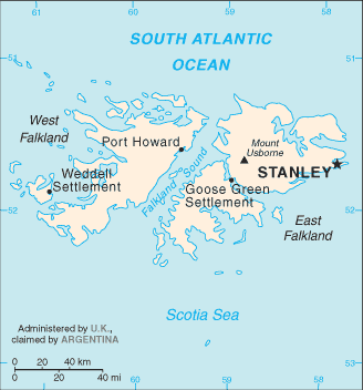
Falkland Islands (Islas Malvinas) Google Maps
To activate Street View on any city of Falkland Islands (Islas Malvinas), drag above the Zoom feature the yellow little man in the map.
Facts about Falkland Islands (Islas Malvinas)
| Administrative divisions: | none (overseas territory of the UK; also claimed by Argentina) |
| Area: | total: 12 ,173 sq km land: 12 ,173 sq km water: 0 sq km note: includes the two main islands of East and West Falkland and about 200 small islands |
| Background: | Although first sighted by an English navigator in 1592 , the first landing (English) did not occur until almost a century later in 1690 , and the first settlement (French) was not established until 1764. The colony was turned over to Spain two years later and the islands have since been the subject of a territorial dispute , first between Britain and Spain , then between Britain and Argentina. The UK asserted its claim to the islands by establishing a naval garrison there in 1833. Argentina invaded the islands on 2 April 1982. The British responded with an expeditionary force that landed seven weeks later and after fierce fighting forced an Argentine surrender on 14 June 1982. |
| Flag description: | blue with the flag of the UK in the upper hoist-side quadrant and the Falkland Island coat of arms centered on the outer half of the flag; the coat of arms contains a white ram (sheep raising was once the major economic activity) above the sailing ship Desire (whose crew discovered the islands) with a scroll at the bottom bearing the motto DESIRE THE RIGHT |
| Capital: | name: Stanley geographic coordinates: 51 42 S , 57 51 W time difference: UTC-4 (1 hour ahead of Washington , DC during Standard Time) daylight saving time: +1hr , begins first Sunday in September; ends third Sunday in April |
| Climate: | cold marine; strong westerly winds , cloudy , humid; rain occurs on more than half of days in year; average annual rainfall is 24 inches in Stanley; occasional snow all year , except in January and February , but does not accumulate |
| Currency code: | Falkland pound (FKP) |
| Ethnic groups: | British |
| Geographic coordinates: | 51 45 S , 59 00 W |
| Geography note: | deeply indented coast provides good natural harbors; short growing season |
| Government type: | NA |
| Imports partners: | UK 72.5% , US 15.1% , Netherlands 8.5% (2006) |
| Internet country code: | .fk |
| Land boundaries: | 1 ,288 km |
| Neighbouring countries: | 0 km |
| Languages: | English |
| Location: | Southern South America , islands in the South Atlantic Ocean , east of southern Argentina |
| Map references: | South America |
| National holiday: | Liberation Day , 14 June (1982) |
| Nationality: | noun: Falkland Islander(s) adjective: Falkland Island |
| Natural hazards: | strong winds persist throughout the year |
| Population: | 3 ,140 (July 2008 est.) |
| Religions: | Christian 67.2% , none 31.5% , other 1.3% (2006 census) |
| Terrain: | rocky , hilly , mountainous with some boggy , undulating plains |
| Unemployment rate: | full employment; labor shortage (2001) |
Capital of Falkland Islands (Islas Malvinas)
Stanley (click to view Stanley map)
Places in Falkland Islands (Islas Malvinas)
Browse the most comprehensive and up-to-date online directory of administrative regions and Street Views in Falkland Islands (Islas Malvinas). Our listings are organized alphabetically, starting from level 1 regions and progressing through to level 2 and eventually level 3 regions, ensuring you can easily navigate and find specific areas of interest.
Bluff Cove Settlement city Google map
Bombilia House city Google map
Burnside House city Google map
Camp Verde city Google map
Carcass Island Settlement city Google map
Ceritos city Google map
Chartres city Google map
Cranmer city Google map
Darwin Settlement city Google map
Dos Lomas city Google map
Douglas Settlement city Google map
Dunnose Head Settlement city Google map
Estancia House city Google map
Fitzroy North city Google map
Fitzroy Settlement city Google map
Foam Creek Settlement city Google map
Fox Bay East Settlement city Google map
Fox Bay West Settlement city Google map
Goose Green Settlement city Google map
Green Patch Settlement city Google map
Hill Cove city Google map
Hope Cottage city Google map
Horseshoe Bay city Google map
Johnson Harbour Settlement city Google map
Keppel Settlement city Google map
Lively Settlement city Google map
Mariquita city Google map
Mid Rancho city Google map
New Island Settlement city Google map
North Arm Settlement city Google map
Orqueta city Google map
Pebble Island Settlement city Google map
Piedra Sola city Google map
Port Howard city Google map
Port Louis Settlement city Google map
Port Louis South city Google map
Port San Carlos Settlement city Google map
Port Stephens Settlement city Google map
Rincon Grande Settlement city Google map
Roy Cove Settlement city Google map
Salvador Settlement city Google map
San Carlos Settlement city Google map
Sand Fountain city Google map
Saunders Island Settlement city Google map
Speedwell Island Settlement city Google map
Spring Point Settlement city Google map
Stanley city Google map
Teal Inlet Settlement city Google map
Tranquilidad city Google map
Walker Creek city Google map
Weddell Settlement city Google map
Westpoint Island Settlement city Google map
Random cities in Falkland Islands (Islas Malvinas)
Stanley, the capital city of Falkland Islands (Islas Malvinas).Fitzroy North
Hope Cottage
Stanley
Darwin Settlement
Dunnose Head Settlement
Horseshoe Bay
Port Louis South
San Carlos Settlement
Spring Point Settlement
Ceritos
Lively Settlement
Tranquilidad
Pebble Island Settlement
Rincon Grande Settlement
Estancia House
Fitzroy Settlement
Cranmer
Fox Bay West Settlement
Dos Lomas
Link to Falkland Islands (Islas Malvinas) Google Maps page
The map of Falkland Islands (Islas Malvinas) has already attracted 3907 views. If you wish to embed our comprehensive Falkland Islands (Islas Malvinas) map on your site, we offer an easy solution. This map includes free access to Google Maps, gazetteer search, detailed country and city maps, Street View, and essential facts, all ready to enhance your website. To use it, simply copy and paste the provided HTML code into your webpage's source code. We appreciate every link back to our Maps and Driving Directions. Thank you for your support!
| Text link to: Falkland Islands (Islas Malvinas) map and facts page |
This Falkland Islands (Islas Malvinas) map is intended solely for informational purposes. No representations or warranties are made concerning its accuracy or reliability. Users assume all risks associated with the use of Google Maps and Google Driving Directions. World Route Planner is not liable for any losses or delays that may occur from using this free Falkland Islands (Islas Malvinas) map.