 Republic of Angola Google Maps and Facts
Welcome to the Google Maps of Angola (AO) and the comprehensive location list for this country. World Route Planner, together with its detailed Angola page, turns Google Maps Sightseeing into a meaningful experience! Our extensive destination gazetteer, coupled with Driving Directions to Angola, allows you to explore Angola through detailed satellite imagery and street views—fast, free, and easier than ever before.
Browse through the list of administrative regions in Angola, navigate through these regions to find a place of interest, and book your hotel with the Best Price Guarantee! Your journey through Angola via Google Satellite Map Sightseeing and Street View starts here.
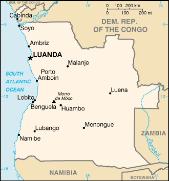
Angola Google Maps
To activate Street View on any city of Angola, drag above the Zoom feature the yellow little man in the map.
Facts about Angola
| Administrative divisions: | 18 provinces (provincias , singular - provincia); Bengo , Benguela , Bie , Cabinda , Cuando Cubango , Cuanza Norte , Cuanza Sul , Cunene , Huambo , Huila , Luanda , Lunda Norte , Lunda Sul , Malanje , Moxico , Namibe , Uige , Zaire |
| Area: | total: 1 ,246 ,700 sq km land: 1 ,246 ,700 sq km water: 0 sq km |
| Background: | Angola is rebuilding its country after the end of a 27-year civil war in 2002. Fighting between the Popular Movement for the Liberation of Angola (MPLA) , led by Jose Eduardo DOS SANTOS , and the National Union for the Total Independence of Angola (UNITA) , led by Jonas SAVIMBI , followed independence from Portugal in 1975. Peace seemed imminent in 1992 when Angola held national elections , but UNITA renewed fighting after being beaten by the MPLA at the polls. Up to 1.5 million lives may have been lost - and 4 million people displaced - in the quarter century of fighting. SAVIMBI's death in 2002 ended UNITA's insurgency and strengthened the MPLA's hold on power. President DOS SANTOS has announced legislative elections will be held in September 2008 , with presidential elections planned for sometime in 2009. |
| Flag description: | two equal horizontal bands of red (top) and black with a centered yellow emblem consisting of a five-pointed star within half a cogwheel crossed by a machete (in the style of a hammer and sickle) |
| Capital: | name: Luanda geographic coordinates: 8 50 S , 13 14 E time difference: UTC+1 (6 hours ahead of Washington , DC during Standard Time) |
| Climate: | semiarid in south and along coast to Luanda; north has cool , dry season (May to October) and hot , rainy season (November to April) |
| Currency code: | kwanza (AOA) |
| Ethnic groups: | Ovimbundu 37% , Kimbundu 25% , Bakongo 13% , mestico (mixed European and native African) 2% , European 1% , other 22% |
| Geographic coordinates: | 12 30 S , 18 30 E |
| Geography note: | the province of Cabinda is an exclave , separated from the rest of the country by the Democratic Republic of the Congo |
| Government type: | republic; multiparty presidential regime |
| Imports partners: | Portugal 18% , US 10% , South Korea 10% , China 9.7% , Brazil 8.1% , South Africa 6% , France 5.8% , UK 4.3% (2007) |
| Internet country code: | .ao |
| Land boundaries: | 1 ,600 km |
| Neighbouring countries: | total: 5 ,198 km border countries: Democratic Republic of the Congo 2 ,511 km (of which 225 km is the boundary of discontiguous Cabinda Province) , Republic of the Congo 201 km , Namibia 1 ,376 km , Zambia 1 ,110 km |
| Languages: | Portuguese (official) , Bantu and other African languages |
| Location: | Southern Africa , bordering the South Atlantic Ocean , between Namibia and Democratic Republic of the Congo |
| Map references: | Africa |
| National holiday: | Independence Day , 11 November (1975) |
| Nationality: | noun: Angolan(s) adjective: Angolan |
| Natural hazards: | locally heavy rainfall causes periodic flooding on the plateau |
| Population: | 12 ,531 ,357 (July 2008 est.) |
| Religions: | indigenous beliefs 47% , Roman Catholic 38% , Protestant 15% (1998 est.) |
| Terrain: | narrow coastal plain rises abruptly to vast interior plateau |
| Unemployment rate: | extensive unemployment and underemployment affecting more than half the population (2001 est.) |
Capital of Republic of Angola
Luanda (click to view Luanda map)
Places in Angola
Browse the most comprehensive and up-to-date online directory of administrative regions and Street Views in Angola. Our listings are organized alphabetically, starting from level 1 regions and progressing through to level 2 and eventually level 3 regions, ensuring you can easily navigate and find specific areas of interest.
Benguela Province (285 google map locations)
Bié Province (234 google map locations)
Cabinda Province (101 google map locations)
Cuando Cubango Province (184 google map locations)
Cunene Province (75 google map locations)
Huambo Province (823 google map locations)
Huila Province (200 google map locations)
Luanda Province (39 google map locations)
Moxico Province (418 google map locations)
Namibe Province (66 google map locations)
North Kwanza Province (444 google map locations)
North Lunda Province (265 google map locations)
South Kwanza Province (510 google map locations)
South Lunda Province (140 google map locations)
Uíge Province (585 google map locations)
Zaire Province (232 google map locations)
Random cities in Angola
Luanda, the capital city of Angola.Trás-os-Montes
Massango
Caiombo
Quicaca
Cassema
Bandeira
Luonguangua
Chipaúa
Quimanga
Cassumba
Cassenda
Morro da Graça
Chissanda
Nhalea
Mufuma
Mussongo
Galileia
Maco do Dula
Quizanza
Link to Angola Google Maps page
The map of Angola has already attracted 6270 views. If you wish to embed our comprehensive Angola map on your site, we offer an easy solution. This map includes free access to Google Maps, gazetteer search, detailed country and city maps, Street View, and essential facts, all ready to enhance your website. To use it, simply copy and paste the provided HTML code into your webpage's source code. We appreciate every link back to our Maps and Driving Directions. Thank you for your support!
| Text link to: Angola map and facts page |
This Angola map is intended solely for informational purposes. No representations or warranties are made concerning its accuracy or reliability. Users assume all risks associated with the use of Google Maps and Google Driving Directions. World Route Planner is not liable for any losses or delays that may occur from using this free Angola map.