 Republic of Cameroon Google Maps and Facts
Welcome to the Google Maps of Cameroon (CM) and the comprehensive location list for this country. World Route Planner, together with its detailed Cameroon page, turns Google Maps Sightseeing into a meaningful experience! Our extensive destination gazetteer, coupled with Driving Directions to Cameroon, allows you to explore Cameroon through detailed satellite imagery and street views—fast, free, and easier than ever before.
Browse through the list of administrative regions in Cameroon, navigate through these regions to find a place of interest, and book your hotel with the Best Price Guarantee! Your journey through Cameroon via Google Satellite Map Sightseeing and Street View starts here.
Cameroon Google Maps
To activate Street View on any city of Cameroon, drag above the Zoom feature the yellow little man in the map.
Facts about Cameroon
| Administrative divisions: | 10 provinces; Adamaoua , Centre , Est , Extreme-Nord , Littoral , Nord , Nord-Ouest , Ouest , Sud , Sud-Ouest |
| Area: | total: 475 ,440 sq km land: 469 ,440 sq km water: 6 ,000 sq km |
| Background: | The former French Cameroon and part of British Cameroon merged in 1961 to form the present country. Cameroon has generally enjoyed stability , which has permitted the development of agriculture , roads , and railways , as well as a petroleum industry. Despite a slow movement toward democratic reform , political power remains firmly in the hands of President Paul BIYA. |
| Flag description: | three equal vertical bands of green (hoist side) , red , and yellow with a yellow five-pointed star centered in the red band note: uses the popular pan-African colors of Ethiopia |
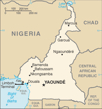
| Capital: | name: Yaounde geographic coordinates: 3 52 N , 11 31 E time difference: UTC+1 (6 hours ahead of Washington , DC during Standard Time) |
| Climate: | varies with terrain , from tropical along coast to semiarid and hot in north |
| Currency code: | Communaute Financiere Africaine franc (XAF); note - responsible authority is the Bank of the Central African States |
| Ethnic groups: | Cameroon Highlanders 31% , Equatorial Bantu 19% , Kirdi 11% , Fulani 10% , Northwestern Bantu 8% , Eastern Nigritic 7% , other African 13% , non-African less than 1% |
| Geographic coordinates: | 6 00 N , 12 00 E |
| Geography note: | sometimes referred to as the hinge of Africa; throughout the country there are areas of thermal springs and indications of current or prior volcanic activity; Mount Cameroon , the highest mountain in Sub-Saharan west Africa , is an active volcano |
| Government type: | republic; multiparty presidential regime |
| Imports partners: | France 23.4% , Nigeria 12.8% , China 9% , Belgium 5.8% , US 4% (2007) |
| Internet country code: | .cm |
| Land boundaries: | 402 km |
| Neighbouring countries: | total: 4 ,591 km border countries: Central African Republic 797 km , Chad 1 ,094 km , Republic of the Congo 523 km , Equatorial Guinea 189 km , Gabon 298 km , Nigeria 1 ,690 km |
| Languages: | 24 major African language groups , English (official) , French (official) |
| Location: | Western Africa , bordering the Bight of Biafra , between Equatorial Guinea and Nigeria |
| Map references: | Africa |
| National holiday: | Republic Day (National Day) , 20 May (1972) |
| Nationality: | noun: Cameroonian(s) adjective: Cameroonian |
| Natural hazards: | volcanic activity with periodic releases of poisonous gases from Lake Nyos and Lake Monoun volcanoes |
| Population: | 18 ,467 ,692 note: estimates for this country explicitly take into account the effects of excess mortality due to AIDS; this can result in lower life expectancy , higher infant mortality , higher death rates , lower population growth rates , and changes in the distribution of population by age and sex than would otherwise be expected (July 2008 est.) |
| Religions: | indigenous beliefs 40% , Christian 40% , Muslim 20% |
| Terrain: | diverse , with coastal plain in southwest , dissected plateau in center , mountains in west , plains in north |
| Unemployment rate: | 30% (2001 est.) |
Capital of Republic of Cameroon
Yaoundé (click to view Yaoundé map)
Places in Cameroon
Browse the most comprehensive and up-to-date online directory of administrative regions and Street Views in Cameroon. Our listings are organized alphabetically, starting from level 1 regions and progressing through to level 2 and eventually level 3 regions, ensuring you can easily navigate and find specific areas of interest.
Centre Province (1581 google map locations)
East Province (841 google map locations)
Far North Province (1218 google map locations)
Littoral Province (641 google map locations)
North-West Province (172 google map locations)
South Province (948 google map locations)
South-West Province (602 google map locations)
West Province (289 google map locations)
Random cities in Cameroon
Yaoundé, the capital city of Cameroon.Sarbalé
Gagadama
Miang
Asanzoa
Sodiko
Barébangé
Dargala
Laboun
Fadjé Fota
Nkoavos
Néméyong
Motcheboum
Muambong I
Bonasson
Kagnol
Sigal
Mme-Bafumen
Sadoka
Mbangou
Link to Cameroon Google Maps page
The map of Cameroon has already attracted 5591 views. If you wish to embed our comprehensive Cameroon map on your site, we offer an easy solution. This map includes free access to Google Maps, gazetteer search, detailed country and city maps, Street View, and essential facts, all ready to enhance your website. To use it, simply copy and paste the provided HTML code into your webpage's source code. We appreciate every link back to our Maps and Driving Directions. Thank you for your support!
| Text link to: Cameroon map and facts page |
This Cameroon map is intended solely for informational purposes. No representations or warranties are made concerning its accuracy or reliability. Users assume all risks associated with the use of Google Maps and Google Driving Directions. World Route Planner is not liable for any losses or delays that may occur from using this free Cameroon map.