 Central African Republic Google Maps and Facts
Map of Central African Republic ⇣ | Google Maps of Central African Republic ⇣ | All Places in Central African Republic ⇣
Welcome to the Google Maps of Central African Republic (CF) and the comprehensive location list for this country. World Route Planner, together with its detailed Central African Republic page, turns Google Maps Sightseeing into a meaningful experience! Our extensive destination gazetteer, coupled with Driving Directions to Central African Republic, allows you to explore Central African Republic through detailed satellite imagery and street views—fast, free, and easier than ever before.
Browse through the list of administrative regions in Central African Republic, navigate through these regions to find a place of interest, and book your hotel with the Best Price Guarantee! Your journey through Central African Republic via Google Satellite Map Sightseeing and Street View starts here.
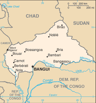
Central African Republic Google Maps
To activate Street View on any city of Central African Republic, drag above the Zoom feature the yellow little man in the map.
Facts about Central African Republic
| Administrative divisions: | 14 prefectures (prefectures , singular - prefecture) , 2 economic prefectures* (prefectures economiques , singular - prefecture economique) , and 1 commune**; Bamingui-Bangoran , Bangui** , Basse-Kotto , Haute-Kotto , Haut-Mbomou , Kemo , Lobaye , Mambere-Kadei , Mbomou , Nana-Grebizi* , Nana-Mambere , Ombella-Mpoko , Ouaka , Ouham , Ouham-Pende , Sangha-Mbaere* , Vakaga |
| Area: | total: 622 ,984 sq km land: 622 ,984 sq km water: 0 sq km |
| Background: | The former French colony of Ubangi-Shari became the Central African Republic upon independence in 1960. After three tumultuous decades of misrule - mostly by military governments - civilian rule was established in 1993 and lasted for one decade. President Ange-Felix PATASSE's civilian government was plagued by unrest , and in March 2003 he was deposed in a military coup led by General Francois BOZIZE , who established a transitional government. Though the government has the tacit support of civil society groups and the main parties , a wide field of candidates contested the municipal , legislative , and presidential elections held in March and May of 2005 in which General BOZIZE was affirmed as president. The government still does not fully control the countryside , where pockets of lawlessness persist. Unrest in neighboring nations , Chad , Sudan , and the DRC , continues to affect stability in the Central African Republic as well. |
| Flag description: | four equal horizontal bands of blue (top) , white , green , and yellow with a vertical red band in center; a yellow five-pointed star to the hoist side of the blue band |
| Capital: | name: Bangui geographic coordinates: 4 22 N , 18 35 E time difference: UTC+1 (6 hours ahead of Washington , DC during Standard Time) |
| Climate: | tropical; hot , dry winters; mild to hot , wet summers |
| Currency code: | Communaute Financiere Africaine franc (XAF); note - responsible authority is the Bank of the Central African States |
| Ethnic groups: | Baya 33% , Banda 27% , Mandjia 13% , Sara 10% , Mboum 7% , M'Baka 4% , Yakoma 4% , other 2% |
| Geographic coordinates: | 7 00 N , 21 00 E |
| Geography note: | landlocked; almost the precise center of Africa |
| Government type: | republic |
| Imports partners: | France 16.2% , Netherlands 12.7% , Cameroon 9.5% , US 6.2% (2007) |
| Internet country code: | .cf |
| Land boundaries: | 0 km (landlocked) |
| Neighbouring countries: | total: 5 ,203 km border countries: Cameroon 797 km , Chad 1 ,197 km , Democratic Republic of the Congo 1 ,577 km , Republic of the Congo 467 km , Sudan 1 ,165 km |
| Languages: | French (official) , Sangho (lingua franca and national language) , tribal languages |
| Location: | Central Africa , north of Democratic Republic of the Congo |
| Map references: | Africa |
| National holiday: | Republic Day , 1 December (1958) |
| Nationality: | noun: Central African(s) adjective: Central African |
| Natural hazards: | hot , dry , dusty harmattan winds affect northern areas; floods are common |
| Population: | 4 ,444 ,330 note: estimates for this country explicitly take into account the effects of excess mortality due to AIDS; this can result in lower life expectancy , higher infant mortality , higher death rates , lower population growth rates , and changes in the distribution of population by age and sex than would otherwise be expected (July 2008 est.) |
| Religions: | indigenous beliefs 35% , Protestant 25% , Roman Catholic 25% , Muslim 15% note: animistic beliefs and practices strongly influence the Christian majority |
| Terrain: | vast , flat to rolling , monotonous plateau; scattered hills in northeast and southwest |
| Unemployment rate: | 8% (23% for Bangui) (2001 est.) |
Capital of Central African Republic
Bangui (click to view Bangui map)
Places in Central African Republic
Browse the most comprehensive and up-to-date online directory of administrative regions and Street Views in Central African Republic. Our listings are organized alphabetically, starting from level 1 regions and progressing through to level 2 and eventually level 3 regions, ensuring you can easily navigate and find specific areas of interest.
Commune de Bangui (5 google map locations)
Kémo Prefecture (207 google map locations)
Lobaye Prefecture (276 google map locations)
Lower Kotto Prefecture (475 google map locations)
Mambéré-Kadéï Prefecture (391 google map locations)
Mbomou Prefecture (350 google map locations)
Nana-Grébizi Prefecture (163 google map locations)
Nana-Mambéré Prefecture (200 google map locations)
Ouaka Prefecture (580 google map locations)
Ouham Prefecture (618 google map locations)
Ouham-Pendé Prefecture (545 google map locations)
Sangha-Mbaéré Prefecture (140 google map locations)
Upper Kotto Prefecture (169 google map locations)
Upper Mbomou Prefecture (139 google map locations)
Vakaga Prefecture (42 google map locations)
Random cities in Central African Republic
Bangui, the capital city of Central African Republic.Caboro
Nouffou
Kokab
Ouango
Bonbe
Imila
Sapoua
Souko
Mbélé
Fafra
Kagimo
Métima
Bokengé
Boban
Mourou Kozo
Angoua
Gazao
Koumbaré
Bokoete
Link to Central African Republic Google Maps page
The map of Central African Republic has already attracted 4146 views. If you wish to embed our comprehensive Central African Republic map on your site, we offer an easy solution. This map includes free access to Google Maps, gazetteer search, detailed country and city maps, Street View, and essential facts, all ready to enhance your website. To use it, simply copy and paste the provided HTML code into your webpage's source code. We appreciate every link back to our Maps and Driving Directions. Thank you for your support!
| Text link to: Central African Republic map and facts page |
This Central African Republic map is intended solely for informational purposes. No representations or warranties are made concerning its accuracy or reliability. Users assume all risks associated with the use of Google Maps and Google Driving Directions. World Route Planner is not liable for any losses or delays that may occur from using this free Central African Republic map.