 Republic of Djibouti Google Maps and facts
Welcome to Google Maps of Djibouti (DJ) and locations list of this country. World Route Planner and its detailed Djibouti page is the place where Google Maps Sightseeing make sense! With comprehensive destination gazetteer, Driving Directions to Djibouti, World Route Planner enables you to explore Djibouti through detailed Satellite Imagery and Street View - fast, free and easy as never before. Browse the list of administrative regions below of Djibouti, follow the navigation through administrative regions to find a place you are interested in and Book your hotel with Best Price Guarantee! Your Djibouti Google Satellite Map Sightseeing and Street View start here.
To activate Street View on any city of Djibouti, drag above the Zoom feature the yellow little man in the map.
Facts about Djibouti
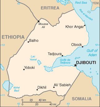
| Administrative divisions: | 6 districts (cercles , singular - cercle); Ali Sabieh , Arta , Dikhil , Djibouti , Obock , Tadjourah |
| Area: | total: 23 ,000 sq km land: 22 ,980 sq km water: 20 sq km |
| Background: | The French Territory of the Afars and the Issas became Djibouti in 1977. Hassan Gouled APTIDON installed an authoritarian one-party state and proceeded to serve as president until 1999. Unrest among the Afars minority during the 1990s led to a civil war that ended in 2001 following the conclusion of a peace accord between Afar rebels and the Issa-dominated government. In 1999 , Djibouti's first multi-party presidential elections resulted in the election of Ismail Omar GUELLEH; he was re-elected to a second and final term in 2005. Djibouti occupies a strategic geographic location at the mouth of the Red Sea and serves as an important transshipment location for goods entering and leaving the east African highlands. The present leadership favors close ties to France , which maintains a significant military presence in the country , but also has strong ties with the US. Djibouti hosts the only US military base in sub-Saharan Africa and is a front-line state in the global war on terrorism. |
| Flag description: | two equal horizontal bands of light blue (top) and light green with a white isosceles triangle based on the hoist side bearing a red five-pointed star in the center |
| Capital: | name: Djibouti geographic coordinates: 11 35 N , 43 09 E time difference: UTC+3 (8 hours ahead of Washington , DC during Standard Time) |
| Climate: | desert; torrid , dry |
| Currency code: | Djiboutian franc (DJF) |
| Ethnic groups: | Somali 60% , Afar 35% , other 5% (includes French , Arab , Ethiopian , and Italian) |
| Geographic coordinates: | 11 30 N , 43 00 E |
| Geography note: | strategic location near world's busiest shipping lanes and close to Arabian oilfields; terminus of rail traffic into Ethiopia; mostly wasteland; Lac Assal (Lake Assal) is the lowest point in Africa |
| Government type: | republic |
| Imports partners: | Saudi Arabia 20.7% , India 17.8% , China 9.3% , Ethiopia 4.6% , Malaysia 4.5% , Japan 4.2% (2007) |
| Internet country code: | .dj |
| Land boundaries: | 314 km |
| Neighbouring countries: | total: 516 km border countries: Eritrea 109 km , Ethiopia 349 km , Somalia 58 km |
| Languages: | French (official) , Arabic (official) , Somali , Afar |
| Location: | Eastern Africa , bordering the Gulf of Aden and the Red Sea , between Eritrea and Somalia |
| Map references: | Africa |
| National holiday: | Independence Day , 27 June (1977) |
| Nationality: | noun: Djiboutian(s) adjective: Djiboutian |
| Natural hazards: | earthquakes; droughts; occasional cyclonic disturbances from the Indian Ocean bring heavy rains and flash floods |
| Population: | 506 ,221 (July 2008 est.) |
| Religions: | Muslim 94% , Christian 6% |
| Terrain: | coastal plain and plateau separated by central mountains |
| Unemployment rate: | 59% in urban areas , 83% in rural areas (2007 est.) |
Capital of Republic of Djibouti
Djibouti (click to view Djibouti map)
Places in Djibouti
Browse the most comprehensive and up-to-date online directory of administrative regions and Street views in Djibouti. Regions are sorted in alphabetical order from level 1 to level 2 and eventually up to level 3 regions.
Dikhil Region (7 google map locations)
Djibouti City (6 google map locations)
Région d' Arta (1 google map locations)
Tadjourah Region (10 google map locations)
Random cities in Djibouti
Djibouti, the capital city of Djibouti.Alaïli Ḏaḏḏa`
La Plaine
Damêrdjôg
Sêdorre
Goubéto
Dorra
Yoboki
`Arta
Moulhoulé
Ambouli
`Assa Gaïla
Djibouti
Ambabbo
Ouê`a
Ḏigri
Gâlâfi
`Ali `Addé
Airolaf
`Ali Sabieh
This Djibouti map is for informational use only. No representation is made or warranty given as to its content. User assumes all risk of using Google Maps and Google Driving Directions. World Route Planner assumes no responsibility for any loss or delay resulting from such use of free Djibouti map.
Link to Djibouti Google Maps page
This map of Djibouti has been viewed 4154 times until now. In case you would like, there is a very easy way how to link to our Djibouti map - including free Google Maps, gazetteer search, country, city maps, Street View and facts -, ready to use on your website. Please, simply copy & paste the provided HTML code into your page source code: Thank you for all links to our Maps and Driving Directions!
| Text link to: Djibouti map |