 Macau Special Administrative Region Google Maps and Facts
Welcome to the Google Maps of Macau (MO) and the comprehensive location list for this country. World Route Planner, together with its detailed Macau page, turns Google Maps Sightseeing into a meaningful experience! Our extensive destination gazetteer, coupled with Driving Directions to Macau, allows you to explore Macau through detailed satellite imagery and street views—fast, free, and easier than ever before.
Browse through the list of administrative regions in Macau, navigate through these regions to find a place of interest, and book your hotel with the Best Price Guarantee! Your journey through Macau via Google Satellite Map Sightseeing and Street View starts here.
Macau Google Maps
To activate Street View on any city of Macau, drag above the Zoom feature the yellow little man in the map.
Facts about Macau
| Administrative divisions: | none (special administrative region of China) |
| Area: | total: 28.2 sq km land: 28.2 sq km water: 0 sq km |
| Background: | Colonized by the Portuguese in the 16th century , Macau was the first European settlement in the Far East. Pursuant to an agreement signed by China and Portugal on 13 April 1987 , Macau became the Macau Special Administrative Region (SAR) of China on 20 December 1999. In this agreement , China promised that , under its "one country , two systems" formula , China's socialist economic system would not be practiced in Macau , and that Macau would enjoy a high degree of autonomy in all matters except foreign and defense affairs for the next 50 years. |
| Flag description: | light green with a lotus flower above a stylized bridge and water in white , beneath an arc of five gold , five-pointed stars: one large in center of arc and four smaller |
| Capital: | |
| Climate: | subtropical; marine with cool winters , warm summers |
| Currency code: | pataca (MOP) |
| Ethnic groups: | Chinese 94.3% , other 5.7% (includes Macanese (mixed Portuguese and Asian ancestry)) (2006 census) |
| Geographic coordinates: | 22 10 N , 113 33 E |
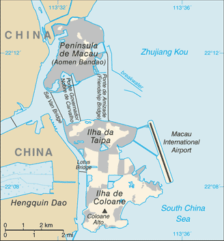
| Geography note: | essentially urban; an area of land reclaimed from the sea measuring 5.2 sq km and known as Cotai now connects the islands of Coloane and Taipa; the island area is connected to the mainland peninsula by three bridges |
| Government type: | limited democracy |
| Imports partners: | China 40% , Hong Kong 15.1% , Japan 7.5% , Chile 5.6% , US 4.8% (2007) |
| Internet country code: | .mo |
| Land boundaries: | 41 km |
| Neighbouring countries: | total: 0.34 km regional border: China 0.34 km |
| Languages: | Cantonese 85.7% , Hokkien 4% , Mandarin 3.2% , other Chinese dialects 2.7% , English 1.5% , Tagalog 1.3% , other 1.6% (2001 census) |
| Location: | Eastern Asia , bordering the South China Sea and China |
| Map references: | Southeast Asia |
| National holiday: | National Day (Anniversary of the Founding of the People's Republic of China) , 1 October (1949); note - 20 December 1999 is celebrated as Macau Special Administrative Region Establishment Day |
| Nationality: | noun: Chinese adjective: Chinese |
| Natural hazards: | typhoons |
| Population: | 545 ,674 (July 2008 est.) |
| Religions: | Buddhist 50% , Roman Catholic 15% , none and other 35% (1997 est.) |
| Terrain: | generally flat |
| Unemployment rate: | 3.1% (2006) |
Capital of Macau Special Administrative Region
[PLACE_CAPITAL] (click to view [PLACE_CAPITAL] map)
Places in Macau
Browse the most comprehensive and up-to-date online directory of administrative regions and Street Views in Macau. Our listings are organized alphabetically, starting from level 1 regions and progressing through to level 2 and eventually level 3 regions, ensuring you can easily navigate and find specific areas of interest.