 Republic of Cuba Google Maps and Facts
Welcome to the Google Maps of Cuba (CU) and the comprehensive location list for this country. World Route Planner, together with its detailed Cuba page, turns Google Maps Sightseeing into a meaningful experience! Our extensive destination gazetteer, coupled with Driving Directions to Cuba, allows you to explore Cuba through detailed satellite imagery and street views—fast, free, and easier than ever before.
Browse through the list of administrative regions in Cuba, navigate through these regions to find a place of interest, and book your hotel with the Best Price Guarantee! Your journey through Cuba via Google Satellite Map Sightseeing and Street View starts here.
Cuba Google Maps
To activate Street View on any city of Cuba, drag above the Zoom feature the yellow little man in the map.
Facts about Cuba
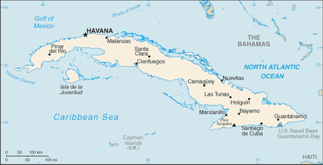
| Administrative divisions: | 14 provinces (provincias , singular - provincia) and 1 special municipality* (municipio especial); Camaguey , Ciego de Avila , Cienfuegos , Ciudad de La Habana , Granma , Guantanamo , Holguin , Isla de la Juventud* , La Habana , Las Tunas , Matanzas , Pinar del Rio , Sancti Spiritus , Santiago de Cuba , Villa Clara |
| Area: | total: 110 ,860 sq km land: 110 ,860 sq km water: 0 sq km |
| Background: | The native Amerindian population of Cuba began to decline after the European discovery of the island by Christopher COLUMBUS in 1492 and following its development as a Spanish colony during the next several centuries. Large numbers of African slaves were imported to work the coffee and sugar plantations , and Havana became the launching point for the annual treasure fleets bound for Spain from Mexico and Peru. Spanish rule , marked initially by neglect , became increasingly repressive , provoking an independence movement and occasional rebellions that were harshly suppressed. It was US intervention during the Spanish-American War in 1898 that finally overthrew Spanish rule. The subsequent Treaty of Paris established Cuban independence , which was granted in 1902 after a three-year transition period. Fidel CASTRO led a rebel army to victory in 1959; his iron rule held the subsequent regime together for nearly five decades. He stepped down as president in February 2008 in favor of his younger brother Raul CASTRO. Cuba's Communist revolution , with Soviet support , was exported throughout Latin America and Africa during the 1960s , 1970s , and 1980s. The country is now slowly recovering from a severe economic downturn in 1990 , following the withdrawal of former Soviet subsidies , worth $4 billion to $6 billion annually. Cuba portrays its difficulties as the result of the US embargo in place since 1961. Illicit migration to the US - using homemade rafts , alien smugglers , air flights , or via the southwest border - is a continuing problem. The US Coast Guard intercepted 2 ,864 individuals attempting to cross the Straits of Florida in fiscal year 2006. |
| Flag description: | five equal horizontal bands of blue (top , center , and bottom) alternating with white; a red equilateral triangle based on the hoist side bears a white , five-pointed star in the center |
| Capital: | name: Havana geographic coordinates: 23 07 N , 82 21 W time difference: UTC-5 (same time as Washington , DC during Standard Time) daylight saving time: +1hr , begins last Sunday in March; ends last Sunday in October |
| Climate: | tropical; moderated by trade winds; dry season (November to April); rainy season (May to October) |
| Currency code: | Cuban peso (CUP) and Convertible peso (CUC) |
| Ethnic groups: | white 65.1% , mulatto and mestizo 24.8% , black 10.1% (2002 census) |
| Geographic coordinates: | 21 30 N , 80 00 W |
| Geography note: | largest country in Caribbean and westernmost island of the Greater Antilles |
| Government type: | Communist state |
| Imports partners: | Venezuela 28.1% , China 12.7% , Spain 9.9% , Canada 5.6% , US 4.9% , Brazil 4.6% (2007) |
| Internet country code: | .cu |
| Land boundaries: | 3 ,735 km |
| Neighbouring countries: | total: 29 km border countries: US Naval Base at Guantanamo Bay 29 km note: Guantanamo Naval Base is leased by the US and remains part of Cuba |
| Languages: | Spanish |
| Location: | Caribbean , island between the Caribbean Sea and the North Atlantic Ocean , 150 km south of Key West , Florida |
| Map references: | Central America and the Caribbean |
| National holiday: | Triumph of the Revolution , 1 January (1959) |
| Nationality: | noun: Cuban(s) adjective: Cuban |
| Natural hazards: | the east coast is subject to hurricanes from August to November (in general , the country averages about one hurricane every other year); droughts are common |
| Population: | 11 ,423 ,952 (July 2008 est.) |
| Religions: | nominally 85% Roman Catholic prior to CASTRO assuming power; Protestants , Jehovah's Witnesses , Jews , and Santeria are also represented |
| Terrain: | mostly flat to rolling plains , with rugged hills and mountains in the southeast |
| Unemployment rate: | 1.8% (2007 est.) |
Capital of Republic of Cuba
La Habana (click to view La Habana map)
Places in Cuba
Browse the most comprehensive and up-to-date online directory of administrative regions and Street Views in Cuba. Our listings are organized alphabetically, starting from level 1 regions and progressing through to level 2 and eventually level 3 regions, ensuring you can easily navigate and find specific areas of interest.
Ciego de Ávila Province (501 google map locations)
Cienfuegos Province (406 google map locations)
Granma Province (444 google map locations)
Guantánamo Province (327 google map locations)
Havana City Province (326 google map locations)
Havana Province (721 google map locations)
Holguín Province (537 google map locations)
Las Tunas Province (429 google map locations)
Matanzas Province (786 google map locations)
Pinar del Río Province (893 google map locations)
Sancti Spíritus Province (343 google map locations)
Santiago de Cuba Province (459 google map locations)
Villa Clara Province (699 google map locations)
Random cities in Cuba
La Habana, the capital city of Cuba.La Jíbara
El Sitio
Cerro
Arango
Ciguatey
Narigueta
Oviedo
La Luisa
Cañada Prieta
Constancia
Mala Noche
San Cayetano
San Salvador
Rincón de la Ceiba
Salado
El Salaíto
Edén
Palmarito de Marcelo
Blas
Link to Cuba Google Maps page
The map of Cuba has already attracted 6911 views. If you wish to embed our comprehensive Cuba map on your site, we offer an easy solution. This map includes free access to Google Maps, gazetteer search, detailed country and city maps, Street View, and essential facts, all ready to enhance your website. To use it, simply copy and paste the provided HTML code into your webpage's source code. We appreciate every link back to our Maps and Driving Directions. Thank you for your support!
| Text link to: Cuba map and facts page |
This Cuba map is intended solely for informational purposes. No representations or warranties are made concerning its accuracy or reliability. Users assume all risks associated with the use of Google Maps and Google Driving Directions. World Route Planner is not liable for any losses or delays that may occur from using this free Cuba map.