 United Kingdom of Great Britain and Northern Ireland Google Maps and Facts
Welcome to the Google Maps of United Kingdom (GB) and the comprehensive location list for this country. World Route Planner, together with its detailed United Kingdom page, turns Google Maps Sightseeing into a meaningful experience! Our extensive destination gazetteer, coupled with Driving Directions to United Kingdom, allows you to explore United Kingdom through detailed satellite imagery and street views—fast, free, and easier than ever before.
Browse through the list of administrative regions in United Kingdom, navigate through these regions to find a place of interest, and book your hotel with the Best Price Guarantee! Your journey through United Kingdom via Google Satellite Map Sightseeing and Street View starts here.
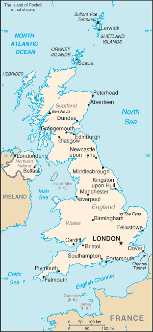
United Kingdom Google Maps
To activate Street View on any city of United Kingdom, drag above the Zoom feature the yellow little man in the map.
Facts about United Kingdom
| Administrative divisions: | England: 34 two-tier counties , 32 London boroughs and 1 City of London or Greater London , 36 metropolitan counties , 46 unitary authorities two-tier counties: Bedfordshire , Buckinghamshire , Cambridgeshire , Cheshire , Cornwall and Isles of Scilly , Cumbria , Derbyshire , Devon , Dorset , Durham , East Sussex , Essex , Gloucestershire , Hampshire , Hertfordshire , Kent , Lancashire , Leicestershire , Lincolnshire , Norfolk , North Yorkshire , Northamptonshire , Northumberland , Nottinghamshire , Oxfordshire , Shropshire , Somerset , Staffordshire , Suffolk , Surrey , Warwickshire , West Sussex , Wiltshire , Worcestershire London boroughs and City of London or Greater London: Barking and Dagenham , Barnet , Bexley , Brent , Bromley , Camden , Croydon , Ealing , Enfield , Greenwich , Hackney , Hammersmith and Fulham , Haringey , Harrow , Havering , Hillingdon , Hounslow , Islington , Kensington and Chelsea , Kingston upon Thames , Lambeth , Lewisham , City of London , Merton , Newham , Redbridge , Richmond upon Thames , Southwark , Sutton , Tower Hamlets , Waltham Forest , Wandsworth , Westminster metropolitan counties: Barnsley , Birmingham , Bolton , Bradford , Bury , Calderdale , Coventry , Doncaster , Dudley , Gateshead , Kirklees , Knowlsey , Leeds , Liverpool , Manchester , Newcastle upon Tyne , North Tyneside , Oldham , Rochdale , Rotherham , Salford , Sandwell , Sefton , Sheffield , Solihull , South Tyneside , St. Helens , Stockport , Sunderland , Tameside , Trafford , Wakefield , Walsall , Wigan , Wirral , Wolverhampton unitary authorities: Bath and North East Somerset , Blackburn with Darwen , Blackpool , Bournemouth , Bracknell Forest , Brighton and Hove , City of Bristol , Darlington , Derby , East Riding of Yorkshire , Halton , Hartlepool , County of Herefordshire , Isle of Wight , City of Kingston upon Hull , Leicester , Luton , Medway , Middlesbrough , Milton Keynes , North East Lincolnshire , North Lincolnshire , North Somerset , Nottingham , Peterborough , Plymouth , Poole , Portsmouth , Reading , Redcar and Cleveland , Rutland , Slough , South Gloucestershire , Southampton , Southend-on-Sea , Stockton-on-Tees , Stoke-on-Trent , Swindon , Telford and Wrekin , Thurrock , Torbay , Warrington , West Berkshire , Windsor and Maidenhead , Wokingham , York Northern Ireland: 26 district council areas district council areas: Antrim , Ards , Armagh , Ballymena , Ballymoney , Banbridge , Belfast , Carrickfergus , Castlereagh , Coleraine , Cookstown , Craigavon , Derry , Down , Dungannon , Fermanagh , Larne , Limavady , Lisburn , Magherafelt , Moyle , Newry and Mourne , Newtownabbey , North Down , Omagh , Strabane Scotland: 32 unitary authorities unitary authorities: Aberdeen City , Aberdeenshire , Angus , Argyll and Bute , Clackmannanshire , Dumfries and Galloway , Dundee City , East Ayrshire , East Dunbartonshire , East Lothian , East Renfrewshire , City of Edinburgh , Eilean Siar (Western Isles) , Falkirk , Fife , Glasgow City , Highland , Inverclyde , Midlothian , Moray , North Ayrshire , North Lanarkshire , Orkney Islands , Perth and Kinross , Renfrewshire , Shetland Islands , South Ayrshire , South Lanarkshire , Stirling , The Scottish Borders , West Dunbartonshire , West Lothian Wales: 22 unitary authorities unitary authorities: Blaenau Gwent; Bridgend; Caerphilly; Cardiff; Carmarthenshire; Ceredigion; Conwy; Denbighshire; Flintshire; Gwynedd; Isle of Anglesey; Merthyr Tydfil; Monmouthshire; Neath Port Talbot; Newport; Pembrokeshire; Powys; Rhondda , Cynon , Taff; Swansea; The Vale of Glamorgan; Torfaen; Wrexham |
| Area: | total: 244 ,820 sq km land: 241 ,590 sq km water: 3 ,230 sq km note: includes Rockall and Shetland Islands |
| Background: | As the dominant industrial and maritime power of the 19th century , the United Kingdom of Great Britain and Ireland played a leading role in developing parliamentary democracy and in advancing literature and science. At its zenith , the British Empire stretched over one-fourth of the earth's surface. The first half of the 20th century saw the UK's strength seriously depleted in two World Wars and the Irish republic withdraw from the union. The second half witnessed the dismantling of the Empire and the UK rebuilding itself into a modern and prosperous European nation. As one of five permanent members of the UN Security Council , a founding member of NATO , and of the Commonwealth , the UK pursues a global approach to foreign policy; it currently is weighing the degree of its integration with continental Europe. A member of the EU , it chose to remain outside the Economic and Monetary Union for the time being. Constitutional reform is also a significant issue in the UK. The Scottish Parliament , the National Assembly for Wales , and the Northern Ireland Assembly were established in 1999 , but the latter was suspended until May 2007 due to wrangling over the peace process. |
| Flag description: | blue field with the red cross of Saint George (patron saint of England) edged in white superimposed on the diagonal red cross of Saint Patrick (patron saint of Ireland) , which is superimposed on the diagonal white cross of Saint Andrew (patron saint of Scotland); properly known as the Union Flag , but commonly called the Union Jack; the design and colors (especially the Blue Ensign) have been the basis for a number of other flags including other Commonwealth countries and their constituent states or provinces , and British overseas territories |
| Capital: | name: London geographic coordinates: 51 30 N , 0 10 W time difference: UTC 0 (5 hours ahead of Washington , DC during Standard Time) daylight saving time: +1hr , begins last Sunday in March; ends last Sunday in October note: applies to the United Kingdom proper , not to its overseas dependencies or territories |
| Climate: | temperate; moderated by prevailing southwest winds over the North Atlantic Current; more than one-half of the days are overcast |
| Currency code: | |
| Ethnic groups: | white (of which English 83.6% , Scottish 8.6% , Welsh 4.9% , Northern Irish 2.9%) 92.1% , black 2% , Indian 1.8% , Pakistani 1.3% , mixed 1.2% , other 1.6% (2001 census) |
| Geographic coordinates: | 54 00 N , 2 00 W |
| Geography note: | lies near vital North Atlantic sea lanes; only 35 km from France and linked by tunnel under the English Channel; because of heavily indented coastline , no location is more than 125 km from tidal waters |
| Government type: | constitutional monarchy |
| Imports partners: | Germany 14.2% , US 8.7% , China 7.3% , Netherlands 7.3% , France 6.9% , Belgium 4.7% , Norway 4.7% , Italy 4.2% (2007) |
| Internet country code: | .uk |
| Land boundaries: | 12 ,429 km |
| Neighbouring countries: | total: 360 km border countries: Ireland 360 km |
| Languages: | English , Welsh (about 26% of the population of Wales) , Scottish form of Gaelic (about 60 ,000 in Scotland) |
| Location: | Western Europe , islands including the northern one-sixth of the island of Ireland between the North Atlantic Ocean and the North Sea , northwest of France |
| Map references: | Europe |
| National holiday: | the UK does not celebrate one particular national holiday |
| Nationality: | noun: Briton(s) , British (collective plural) adjective: British |
| Natural hazards: | winter windstorms; floods |
| Population: | 60 ,943 ,912 (July 2008 est.) |
| Religions: | Christian (Anglican , Roman Catholic , Presbyterian , Methodist) 71.6% , Muslim 2.7% , Hindu 1% , other 1.6% , unspecified or none 23.1% (2001 census) |
| Terrain: | mostly rugged hills and low mountains; level to rolling plains in east and southeast |
| Unemployment rate: | 5.3% (2007 est.) |
Capital of United Kingdom of Great Britain and Northern Ireland
London (click to view London map)
Places in United Kingdom
Browse the most comprehensive and up-to-date online directory of administrative regions and Street Views in United Kingdom. Our listings are organized alphabetically, starting from level 1 regions and progressing through to level 2 and eventually level 3 regions, ensuring you can easily navigate and find specific areas of interest.
Berkshire city Google map
Borough of Barnsley city Google map
Borough of Blackburn with Darwen city Google map
Borough of Blackpool city Google map
Borough of Bolton city Google map
Borough of Bournemouth city Google map
Borough of Bracknell Forest city Google map
Borough of Brighton and Hove city Google map
Borough of Bury city Google map
Borough of Calderdale city Google map
Borough of Darlington city Google map
Borough of Doncaster city Google map
Borough of Dudley city Google map
Borough of Gateshead city Google map
Borough of Halton city Google map
Borough of Hartlepool city Google map
Borough of Kirklees city Google map
Borough of Knowsley city Google map
Borough of Luton city Google map
Borough of Medway city Google map
Borough of Middlesbrough city Google map
Borough of Milton Keynes city Google map
Borough of North Tyneside city Google map
Borough of Oldham city Google map
Borough of Poole city Google map
Borough of Reading city Google map
Borough of Redcar and Cleveland city Google map
Borough of Rochdale city Google map
Borough of Rotherham city Google map
Borough of Sandwell city Google map
Borough of Sefton city Google map
Borough of Slough city Google map
Borough of Solihull city Google map
Borough of South Tyneside city Google map
Borough of Southend-on-Sea city Google map
Borough of St. Helens city Google map
Borough of Stockport city Google map
Borough of Stockton-on-Tees city Google map
Borough of Swindon city Google map
Borough of Tameside city Google map
Borough of Thurrock city Google map
Borough of Torbay city Google map
Borough of Trafford city Google map
Borough of Walsall city Google map
Borough of Warrington city Google map
Borough of Wigan city Google map
Borough of Wirral city Google map
Borough of Wolverhampton city Google map
Bristol city Google map
Buckinghamshire city Google map
Cambridgeshire city Google map
Cheshire city Google map
City and Borough of Birmingham city Google map
City and Borough of Bradford city Google map
City and Borough of Coventry city Google map
City and Borough of Leeds city Google map
City and Borough of Liverpool city Google map
City and Borough of Manchester city Google map
City and Borough of Newcastle upon Tyne city Google map
City and Borough of Salford city Google map
City and Borough of Sheffield city Google map
City and Borough of Sunderland city Google map
City and Borough of Wakefield city Google map
City and London Borough of Westminster city Google map
City of Bristol city Google map
City of Derby city Google map
City of Kingston upon Hull city Google map
City of Leicester city Google map
City of London city Google map
City of Nottingham city Google map
City of Peterborough city Google map
City of Plymouth city Google map
City of Portsmouth city Google map
City of Southampton city Google map
City of Stoke-on-Trent city Google map
City of York city Google map
Cornwall city Google map
County Durham city Google map
County Durham city Google map
County of Bedfordshire city Google map
County of Buckinghamshire city Google map
County of Cambridgeshire city Google map
County of Cheshire city Google map
County of Cornwall city Google map
County of Cumbria city Google map
County of Derbyshire city Google map
County of Devon city Google map
County of Dorset city Google map
County of East Sussex city Google map
County of Essex city Google map
County of Gloucestershire city Google map
County of Hampshire city Google map
County of Herefordshire city Google map
County of Hertfordshire city Google map
County of Isle of Wight city Google map
County of Kent city Google map
County of Lancashire city Google map
County of Leicestershire city Google map
County of Lincolnshire city Google map
County of Norfolk city Google map
County of North Yorkshire city Google map
County of Northumberland city Google map
County of Nottinghamshire city Google map
County of Oxfordshire city Google map
County of Shropshire city Google map
County of Somerset city Google map
County of Staffordshire city Google map
County of Suffolk city Google map
County of Surrey city Google map
County of Warwickshire city Google map
County of West Sussex city Google map
County of Wiltshire city Google map
County of Worcestershire city Google map
Cumbria city Google map
Derbyshire city Google map
Devon city Google map
District of Bath and North East Somerset city Google map
District of East Riding of Yorkshire city Google map
District of North East Lincolnshire city Google map
District of North Lincolnshire city Google map
District of North Somerset city Google map
District of Rutland city Google map
District of South Gloucestershire city Google map
District of Telford and Wrekin city Google map
District of West Berkshire city Google map
District of Wokingham city Google map
Dorset city Google map
East Riding of Yorkshire city Google map
East Sussex city Google map
England (10427 google map locations)
Essex city Google map
Gloucestershire city Google map
Greater London city Google map
Greater Manchester city Google map
Hampshire city Google map
Herefordshire city Google map
Hertfordshire city Google map
Isle of Wight city Google map
Isles of Scilly city Google map
Kent city Google map
Lancashire city Google map
Leicestershire city Google map
Lincolnshire city Google map
Lincolnshire city Google map
London Borough of Barking and Dagenham city Google map
London Borough of Barnet city Google map
London Borough of Bexley city Google map
London Borough of Brent city Google map
London Borough of Bromley city Google map
London Borough of Camden city Google map
London Borough of Croydon city Google map
London Borough of Ealing city Google map
London Borough of Enfield city Google map
London Borough of Greenwich city Google map
London Borough of Hackney city Google map
London Borough of Hammersmith and Fulham city Google map
London Borough of Haringey city Google map
London Borough of Harrow city Google map
London Borough of Havering city Google map
London Borough of Hillingdon city Google map
London Borough of Hounslow city Google map
London Borough of Islington city Google map
London Borough of Lambeth city Google map
London Borough of Lewisham city Google map
London Borough of Merton city Google map
London Borough of Newham city Google map
London Borough of Redbridge city Google map
London Borough of Richmond upon Thames city Google map
London Borough of Southwark city Google map
London Borough of Sutton city Google map
London Borough of Tower Hamlets city Google map
London Borough of Waltham Forest city Google map
London Borough of Wandsworth city Google map
Merseyside city Google map
Norfolk city Google map
North Yorkshire city Google map
North Yorkshire city Google map
Northamptonshire city Google map
Northern Ireland (641 google map locations)
Northumberland city Google map
Nottinghamshire city Google map
Oxfordshire city Google map
Royal Borough of Windsor and Maidenhead city Google map
Royal London Borough of Kensington and Chelsea city Google map
Royal London Borough of Kingston upon Thames city Google map
Rutland city Google map
Scotland (2474 google map locations)
Shropshire city Google map
Somerset city Google map
South Yorkshire city Google map
Staffordshire city Google map
Suffolk city Google map
Surrey city Google map
Tine and Wear city Google map
Wales (1378 google map locations)
Warwickshire city Google map
West Midlands city Google map
West Sussex city Google map
West Yorkshire city Google map
Wiltshire city Google map
Worcestershire city Google map
Random cities in United Kingdom
London, the capital city of United Kingdom.Llandyry
Deptford
Broom
Ederny
Tilty
Brackley
Goodmayes
Cleasby
Teigngrace
Enderby
Kelsale
Kingsthorpe
Curdridge
Porton
Swilland
Kingston
Marholm
Edgefield
Flitton
Link to United Kingdom Google Maps page
The map of United Kingdom has already attracted 10126 views. If you wish to embed our comprehensive United Kingdom map on your site, we offer an easy solution. This map includes free access to Google Maps, gazetteer search, detailed country and city maps, Street View, and essential facts, all ready to enhance your website. To use it, simply copy and paste the provided HTML code into your webpage's source code. We appreciate every link back to our Maps and Driving Directions. Thank you for your support!
| Text link to: United Kingdom map and facts page |
This United Kingdom map is intended solely for informational purposes. No representations or warranties are made concerning its accuracy or reliability. Users assume all risks associated with the use of Google Maps and Google Driving Directions. World Route Planner is not liable for any losses or delays that may occur from using this free United Kingdom map.