 Eastern Republic of the Uruguay Google Maps and Facts
Welcome to the Google Maps of Uruguay (UY) and the comprehensive location list for this country. World Route Planner, together with its detailed Uruguay page, turns Google Maps Sightseeing into a meaningful experience! Our extensive destination gazetteer, coupled with Driving Directions to Uruguay, allows you to explore Uruguay through detailed satellite imagery and street views—fast, free, and easier than ever before.
Browse through the list of administrative regions in Uruguay, navigate through these regions to find a place of interest, and book your hotel with the Best Price Guarantee! Your journey through Uruguay via Google Satellite Map Sightseeing and Street View starts here.
Uruguay Google Maps
To activate Street View on any city of Uruguay, drag above the Zoom feature the yellow little man in the map.
Facts about Uruguay
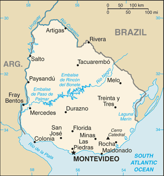
| Administrative divisions: | 19 departments (departamentos , singular - departamento); Artigas , Canelones , Cerro Largo , Colonia , Durazno , Flores , Florida , Lavalleja , Maldonado , Montevideo , Paysandu , Rio Negro , Rivera , Rocha , Salto , San Jose , Soriano , Tacuarembo , Treinta y Tres |
| Area: | total: 176 ,220 sq km land: 173 ,620 sq km water: 2 ,600 sq km |
| Background: | Montevideo , founded by the Spanish in 1726 as a military stronghold , soon took advantage of its natural harbor to become an important commercial center. Claimed by Argentina but annexed by Brazil in 1821 , Uruguay declared its independence four years later and secured its freedom in 1828 after a three-year struggle. The administrations of President Jose BATLLE in the early 20th century established widespread political , social , and economic reforms that established a statist tradition. A violent Marxist urban guerrilla movement named the Tupamaros , launched in the late 1960s , led Uruguay's president to cede control of the government to the military in 1973. By yearend , the rebels had been crushed , but the military continued to expand its hold over the government. Civilian rule was not restored until 1985. In 2004 , the left-of-center Frente Amplio Coalition won national elections that effectively ended 170 years of political control previously held by the Colorado and Blanco parties. Uruguay's political and labor conditions are among the freest on the continent. |
| Flag description: | nine equal horizontal stripes of white (top and bottom) alternating with blue; a white square in the upper hoist-side corner with a yellow sun bearing a human face known as the Sun of May with 16 rays that alternate between triangular and wavy |
| Capital: | name: Montevideo geographic coordinates: 34 53 S , 56 11 W time difference: UTC-3 (2 hours ahead of Washington , DC during Standard Time) daylight saving time: +1hr , begins second Sunday in October; ends second Sunday in March |
| Climate: | warm temperate; freezing temperatures almost unknown |
| Currency code: | |
| Ethnic groups: | white 88% , mestizo 8% , black 4% , Amerindian (practically nonexistent) |
| Geographic coordinates: | 33 00 S , 56 00 W |
| Geography note: | second-smallest South American country (after Suriname); most of the low-lying landscape (three-quarters of the country) is grassland , ideal for cattle and sheep raising |
| Government type: | constitutional republic |
| Imports partners: | Argentina 21.5% , Brazil 18% , US 9.3% , China 8.9% , Paraguay 7.5% , Nigeria 4.5% (2007) |
| Internet country code: | .uy |
| Land boundaries: | 660 km |
| Neighbouring countries: | total: 1 ,648 km border countries: Argentina 580 km , Brazil 1 ,068 km |
| Languages: | Spanish , Portunol , or Brazilero (Portuguese-Spanish mix on the Brazilian frontier) |
| Location: | Southern South America , bordering the South Atlantic Ocean , between Argentina and Brazil |
| Map references: | South America |
| National holiday: | Independence Day , 25 August (1825) |
| Nationality: | noun: Uruguayan(s) adjective: Uruguayan |
| Natural hazards: | seasonally high winds (the pampero is a chilly and occasional violent wind that blows north from the Argentine pampas) , droughts , floods; because of the absence of mountains , which act as weather barriers , all locations are particularly vulnerable to rapid changes from weather fronts |
| Population: | 3 ,477 ,778 (July 2008 est.) |
| Religions: | Roman Catholic 47.1% , non-Catholic Christians 11.1% , nondenominational 23.2% , Jewish 0.3% , atheist or agnostic 17.2% , other 1.1% (2006) |
| Terrain: | mostly rolling plains and low hills; fertile coastal lowland |
| Unemployment rate: | 9.2% (2007 est.) |
Capital of Eastern Republic of the Uruguay
Montevideo (click to view Montevideo map)
Places in Uruguay
Browse the most comprehensive and up-to-date online directory of administrative regions and Street Views in Uruguay. Our listings are organized alphabetically, starting from level 1 regions and progressing through to level 2 and eventually level 3 regions, ensuring you can easily navigate and find specific areas of interest.
Canelones Department (53 google map locations)
Cerro Largo Department (46 google map locations)
Colonia Department (49 google map locations)
Durazno Department (43 google map locations)
Flores Department (16 google map locations)
Florida Department (32 google map locations)
Lavalleja Department (34 google map locations)
Maldonado Department (16 google map locations)
Montevideo Department (46 google map locations)
Río Negro Department (27 google map locations)
Rivera Department (39 google map locations)
Rocha Department (29 google map locations)
Salto Department (51 google map locations)
San José Department (30 google map locations)
Soriano Department (32 google map locations)
Tacuarembó Department (82 google map locations)
Treinta y Tres Department (28 google map locations)
Random cities in Uruguay
Montevideo, the capital city of Uruguay.Poblado Echeverry
Miguelete
Saucedo
Porvenir
Salto
Gervasio
San Dios
Paso del León
Sarandí
Arenitas Blancas
Orgoroso
Pedrera
Veinticinco de Mayo
Corral de Piedra
Cerros de los Rochas
Pueblo de la Arena
Los Feos
Ramón Trigo
Colón
Link to Uruguay Google Maps page
The map of Uruguay has already attracted 10041 views. If you wish to embed our comprehensive Uruguay map on your site, we offer an easy solution. This map includes free access to Google Maps, gazetteer search, detailed country and city maps, Street View, and essential facts, all ready to enhance your website. To use it, simply copy and paste the provided HTML code into your webpage's source code. We appreciate every link back to our Maps and Driving Directions. Thank you for your support!
| Text link to: Uruguay map and facts page |
This Uruguay map is intended solely for informational purposes. No representations or warranties are made concerning its accuracy or reliability. Users assume all risks associated with the use of Google Maps and Google Driving Directions. World Route Planner is not liable for any losses or delays that may occur from using this free Uruguay map.