 Bolivarian Republic of Venezuela Google Maps and Facts
Welcome to the Google Maps of Venezuela (VE) and the comprehensive location list for this country. World Route Planner, together with its detailed Venezuela page, turns Google Maps Sightseeing into a meaningful experience! Our extensive destination gazetteer, coupled with Driving Directions to Venezuela, allows you to explore Venezuela through detailed satellite imagery and street views—fast, free, and easier than ever before.
Browse through the list of administrative regions in Venezuela, navigate through these regions to find a place of interest, and book your hotel with the Best Price Guarantee! Your journey through Venezuela via Google Satellite Map Sightseeing and Street View starts here.
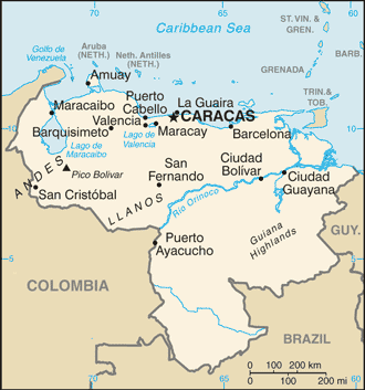
Venezuela Google Maps
To activate Street View on any city of Venezuela, drag above the Zoom feature the yellow little man in the map.
Facts about Venezuela
| Administrative divisions: | 23 states (estados , singular - estado) , 1 capital district* (distrito capital) , and 1 federal dependency** (dependencia federal); Amazonas , Anzoategui , Apure , Aragua , Barinas , Bolivar , Carabobo , Cojedes , Delta Amacuro , Dependencias Federales** , Distrito Federal* , Falcon , Guarico , Lara , Merida , Miranda , Monagas , Nueva Esparta , Portuguesa , Sucre , Tachira , Trujillo , Vargas , Yaracuy , Zulia note: the federal dependency consists of 11 federally controlled island groups with a total of 72 individual islands |
| Area: | total: 912 ,050 sq km land: 882 ,050 sq km water: 30 ,000 sq km |
| Background: | Venezuela was one of three countries that emerged from the collapse of Gran Colombia in 1830 (the others being Ecuador and New Granada , which became Colombia). For most of the first half of the 20th century , Venezuela was ruled by generally benevolent military strongmen , who promoted the oil industry and allowed for some social reforms. Democratically elected governments have held sway since 1959. Hugo CHAVEZ , president since 1999 , seeks to implement his "21st Century Socialism ," which purports to alleviate social ills while at the same time attacking globalization and undermining regional stability. Current concerns include: a weakening of democratic institutions , political polarization , a politicized military , drug-related violence along the Colombian border , increasing internal drug consumption , overdependence on the petroleum industry with its price fluctuations , and irresponsible mining operations that are endangering the rain forest and indigenous peoples. |
| Flag description: | three equal horizontal bands of yellow (top) , blue , and red with the coat of arms on the hoist side of the yellow band and an arc of eight white five-pointed stars centered in the blue band |
| Capital: | name: Caracas geographic coordinates: 10 30 N , 66 56 W time difference: UTC-4.5 (half an hour ahead of Washington , DC during Standard Time) |
| Climate: | tropical; hot , humid; more moderate in highlands |
| Currency code: | |
| Ethnic groups: | Spanish , Italian , Portuguese , Arab , German , African , indigenous people |
| Geographic coordinates: | 8 00 N , 66 00 W |
| Geography note: | on major sea and air routes linking North and South America; Angel Falls in the Guiana Highlands is the world's highest waterfall |
| Government type: | federal republic |
| Imports partners: | US 26.6% , Colombia 13.5% , Brazil 9.5% , China 6.7% , Mexico 5.2% , Panama 5% (2007) |
| Internet country code: | .ve |
| Land boundaries: | 2 ,800 km |
| Neighbouring countries: | total: 4 ,993 km border countries: Brazil 2 ,200 km , Colombia 2 ,050 km , Guyana 743 km |
| Languages: | Spanish (official) , numerous indigenous dialects |
| Location: | Northern South America , bordering the Caribbean Sea and the North Atlantic Ocean , between Colombia and Guyana |
| Map references: | South America |
| National holiday: | Independence Day , 5 July (1811) |
| Nationality: | noun: Venezuelan(s) adjective: Venezuelan |
| Natural hazards: | subject to floods , rockslides , mudslides; periodic droughts |
| Population: | 26 ,414 ,816 (July 2008 est.) |
| Religions: | nominally Roman Catholic 96% , Protestant 2% , other 2% |
| Terrain: | Andes Mountains and Maracaibo Lowlands in northwest; central plains (llanos); Guiana Highlands in southeast |
| Unemployment rate: | 8.5% (2007 est.) |
Capital of Bolivarian Republic of Venezuela
Caracas (click to view Caracas map)
Places in Venezuela
Browse the most comprehensive and up-to-date online directory of administrative regions and Street Views in Venezuela. Our listings are organized alphabetically, starting from level 1 regions and progressing through to level 2 and eventually level 3 regions, ensuring you can easily navigate and find specific areas of interest.
Anzoátegui State (1305 google map locations)
Apure State (987 google map locations)
Aragua State (491 google map locations)
Barinas State (1003 google map locations)
Bolívar State (1159 google map locations)
Capital District (97 google map locations)
Carabobo State (385 google map locations)
Cojedes State (569 google map locations)
Delta Amacuro State (117 google map locations)
Estado Vargas (207 google map locations)
Falcón State (1535 google map locations)
Federal Dependencies (1 google map locations)
Lara State (1310 google map locations)
Mérida State (709 google map locations)
Miranda State (1120 google map locations)
Monagas State (747 google map locations)
Nueva Esparta State (154 google map locations)
Portuguesa State (703 google map locations)
Sucre State (990 google map locations)
Táchira State (761 google map locations)
Trujillo State (574 google map locations)
Yaracuy State (356 google map locations)
Zulia State (1463 google map locations)
Random cities in Venezuela
Caracas, the capital city of Venezuela.Bajo el Burro
Teta del Diablo
El Puente
Jurupú
Cambural
Los Montones
Kilómetro Dieciséis
Río Claro
El Rincón
La Vega
La Legua
Ramo Verde
Samanote
El Resguardo
Morichito
La Carbonera
Mata Negra
Los Verales
San Ramón
Link to Venezuela Google Maps page
The map of Venezuela has already attracted 6353 views. If you wish to embed our comprehensive Venezuela map on your site, we offer an easy solution. This map includes free access to Google Maps, gazetteer search, detailed country and city maps, Street View, and essential facts, all ready to enhance your website. To use it, simply copy and paste the provided HTML code into your webpage's source code. We appreciate every link back to our Maps and Driving Directions. Thank you for your support!
| Text link to: Venezuela map and facts page |
This Venezuela map is intended solely for informational purposes. No representations or warranties are made concerning its accuracy or reliability. Users assume all risks associated with the use of Google Maps and Google Driving Directions. World Route Planner is not liable for any losses or delays that may occur from using this free Venezuela map.