 Territory of Cocos (Keeling) Islands Google Maps and Facts
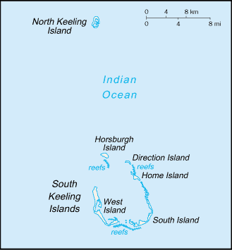
Map of Cocos (Keeling) Islands ⇣ | Google Maps of Cocos (Keeling) Islands ⇣ | All Places in Cocos (Keeling) Islands ⇣
Welcome to the Google Maps of Cocos (Keeling) Islands (CC) and the comprehensive location list for this country. World Route Planner, together with its detailed Cocos (Keeling) Islands page, turns Google Maps Sightseeing into a meaningful experience! Our extensive destination gazetteer, coupled with Driving Directions to Cocos (Keeling) Islands, allows you to explore Cocos (Keeling) Islands through detailed satellite imagery and street views—fast, free, and easier than ever before.
Browse through the list of administrative regions in Cocos (Keeling) Islands, navigate through these regions to find a place of interest, and book your hotel with the Best Price Guarantee! Your journey through Cocos (Keeling) Islands via Google Satellite Map Sightseeing and Street View starts here.
Cocos (Keeling) Islands Google Maps
To activate Street View on any city of Cocos (Keeling) Islands, drag above the Zoom feature the yellow little man in the map.
Facts about Cocos (Keeling) Islands
| Administrative divisions: | none (territory of Australia) |
| Area: | total: 14 sq km land: 14 sq km water: 0 sq km note: includes the two main islands of West Island and Home Island |
| Background: | There are 27 coral islands in the group. Captain William KEELING discovered the islands in 1609 , but they remained uninhabited until the 19th century. From the 1820s to 1978 , members of the CLUNIE-ROSS family controlled the islands and the copra produced from local coconuts. Annexed by the UK in 1857 , the Cocos Islands were transferred to the Australian Government in 1955. The population on the two inhabited islands generally is split between the ethnic Europeans on West Island and the ethnic Malays on Home Island. |
| Flag description: | the flag of Australia is used |
| Capital: | name: West Island geographic coordinates: 12 10 S , 96 50 E time difference: UTC+6.5 (11.5 hours ahead of Washington , DC during Standard Time) |
| Climate: | tropical with high humidity , moderated by the southeast trade winds for about nine months of the year |
| Currency code: | Australian dollar (AUD) |
| Ethnic groups: | Europeans , Cocos Malays |
| Geographic coordinates: | 12 30 S , 96 50 E |
| Geography note: | islands are thickly covered with coconut palms and other vegetation; site of a World War I naval battle in November 1914 between the Australian light cruiser HMAS Sydney and the German raider SMS Emden; after being heavily damaged in the engagement , the Emden was beached by her captain on North Keeling Island |
| Government type: | NA |
| Imports partners: | Australia (2006) |
| Internet country code: | .cc |
| Land boundaries: | 26 km |
| Neighbouring countries: | 0 km |
| Languages: | Malay (Cocos dialect) , English |
| Location: | Southeastern Asia , group of islands in the Indian Ocean , southwest of Indonesia , about halfway from Australia to Sri Lanka |
| Map references: | Southeast Asia |
| National holiday: | Australia Day , 26 January (1788) |
| Nationality: | noun: Cocos Islander(s) adjective: Cocos Islander |
| Natural hazards: | cyclone season is October to April |
| Population: | 596 (July 2007 est.) |
| Religions: | Sunni Muslim 80% , other 20% (2002 est.) |
| Terrain: | flat , low-lying coral atolls |
| Unemployment rate: | 60% (2000 est.) |
Capital of Territory of Cocos (Keeling) Islands
[PLACE_CAPITAL] (click to view [PLACE_CAPITAL] map)
Places in Cocos (Keeling) Islands
Browse the most comprehensive and up-to-date online directory of administrative regions and Street Views in Cocos (Keeling) Islands. Our listings are organized alphabetically, starting from level 1 regions and progressing through to level 2 and eventually level 3 regions, ensuring you can easily navigate and find specific areas of interest.