Africa Google Maps
The landscape of global sovereignty has dramatically shifted over the past several decades. From just 82 sovereign states in 1950, the number has surged to almost 200 today. This rise can largely be attributed to the fervent push for national self-determination following eras of colonialism and oppression. As the world map has become increasingly dotted with more borders, international border disputes have simultaneously risen. Often fueled by religious or ethnic motivations, these newfound independences have sometimes led to intense internal conflicts, particularly with minority groups. While many nations have transitioned into independence with relative peace, adopting forms of government ranging from multiparty democracies to more centralized powers, others have experienced tumultuous power struggles, occasionally resulting in military dictatorships or individual despots. These early stages of nationhood are critical in shaping the future of emerging states.
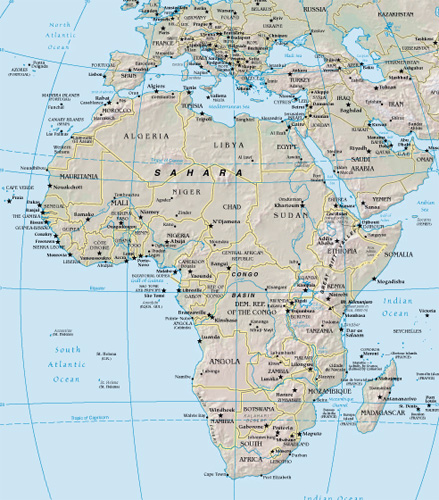
World Route Planner offers an extensive Africa gazetteer, powered by Google Maps, providing detailed Driving Directions and Google Street View across the cities of Africa. Our collaboration with Google Maps delivers the most comprehensive online satellite imagery available, enhancing your exploration of Africa. Our database covers thousands of locations in Africa, categorized by countries, counties, administrative regions, and cities. Additionally, World Route Planner provides precise Time Zones and Daylight maps for Africa. Take advantage of this wealth of information and start exploring Africa with Google Maps today!
Google Maps of Africa
To access Google Street View for any city in Africa, simply drag the yellow pegman icon located above the zoom controls directly onto the map. This will activate the Street View feature, allowing you to explore the streets and landmarks of Africa up close.
Facts of Africa
The world’s second-largest continent, Africa, covers an area of 11,712,434 sq miles (30,355,000 sq km). It has 57 separate countries, including Madagascar, Comoros, Mauritius, and the Seychelles in the Indian Ocean – the highest number of any continent.- Greatest extent, North-South: 4737 miles / 7623 km
- Greatest extent, East-West: 4511 miles / 7260 km
- Most northerly point: Jalta, Tunisia 37° 31’ N
- Most southerly point: Cape Agulhas, South Africa 34° 52’ S
- Most easterly point: Raas Xaafuun, Somalia 51° 24’ E
- Highest recorded temperature: Al ‘Aziziyah, Libya 136°F (58°C)
- Lowest recorded temperature: Ifrane, Morocco -11°F (-24°C)
- Most westerly point: Santo Antão, Cape Verde 25° 11’ W
- Largest lake: Lake Victoria, Uganda/Kenya/Tanzania 26,560 sq miles (68,880 sq km)
- Highest point: Kilimanjaro, Tanzania, 19,341 ft (5895 m)
- Lowest point: Lac ‘Assal, Djibouti -512 ft (-156 m) below sea level
Northern Africa
Northern Africa comprises a system of basins and plateaus. The Tibesti and Ahaggar are volcanic uplands whose uplift has been matched by subsidence within large surrounding basins. Many of the basins have been infilled with sand and gravel, creating the vast Saharan lands. The convergence of the African and Eurasian plates formed the Atlas Mountains in the north.Southern Africa
The Great Escarpment marks the southern boundary of Africa’s basement rock and includes the Drakensberg range. It was uplifted when Gondwanaland fragmented about 160 million years ago and gradually eroded back from the coast. To the north, the relief drops steadily, forming the Kalahari Basin. In the far south are the fold mountains of the Great Karoo.East Africa
The Great Rift Valley is the most striking feature of this region, running for 4475 miles (7200 km) from Lake Nyasa to the Red Sea. North of Lake Nyasa, it splits into two arms and encloses an interior plateau that contains Lake Victoria. Several elongated lakes and volcanoes lie along the fault lines. To the west lies the Congo Basin, a vast, shallow depression that rises to form an almost circular rim of highlands.Climate
The climates of Africa range from Mediterranean to arid, dry savannah, and humid equatorial. In East Africa, where snow settles at the summit of volcanoes such as Kilimanjaro, the climate is also modified by altitude. The winds of the Sahara export millions of tonnes of dust a year, both northward and eastward.Shaping the continent
African landscapes are shaped by the intensity of climatic extremes and by tectonic action. High aridity, wind action, and infrequent but heavy rainstorms lead to the migration of sand dunes and dramatic flash flooding across much of the north and west. In the wetter areas, high precipitation increases the rate of weathering. To the east, the rift system has created a volcanic and lake environment and allowed rivers to erode weaknesses left in the crustal structure by faults.Political Africa
The political map of modern Africa only emerged following the end of the Second World War. Over the next half-century, all of the countries formerly controlled by European powers gained independence from their colonial rulers – only Liberia and Ethiopia were never colonized. The postcolonial era has not been an easy period for many countries, but there have been moves toward multiparty democracy across much of the continent. In South Africa, democratic elections replaced the internationally condemned apartheid system only in 1994. Other countries still have to find political stability; corruption in government and ethnic tensions are serious problems. Based on the colonial transportation systems built to exploit Africa’s resources, national infrastructures are often inappropriate for independent economic development.Transportation
African railroads were built to aid the exploitation of natural resources, and most offer passage only from the interior to the coastal cities, leaving large parts of the continent untouched – five landlocked countries have no railroads at all. The Congo, Nile, and Niger river networks offer limited access to land within the continental interior but have several waterfalls and cataracts which prevent navigation from the sea. Many roads were developed in the 1960s and 1970s, but economic difficulties make the maintenance and expansion of the networks difficult.Population
Africa has a rapidly growing population of over 900 million people, yet over 75% of the continent remains sparsely populated. Most Africans still pursue a traditional rural lifestyle, though urbanization is increasing as people move to the cities for employment. The greatest population densities occur where water is more readily available, such as in the Nile Valley, the coasts of North and West Africa, along the Niger, the eastern African highlands, and in South Africa.Languages
Three major world languages act as lingua francas across Africa: Arabic in North Africa, English in southern and eastern Africa and Nigeria, and French in Central and West Africa and Madagascar. A huge number of African languages are spoken as well – over 2000 have been recorded, with more than 400 in Nigeria alone – reflecting the continuing importance of traditional cultures and values. The extensive use of Arabic reflects Middle Eastern influences in the north of the continent, while Bantu languages are widely spoken across much of southern Africa.African resources
The economies of most African countries are dominated by subsistence and cash crop agriculture, with limited industrialization. Manufacturing is largely confined to South Africa. Many countries depend on a single resource, such as copper or gold, or a cash crop, such as coffee, for export income, leaving them vulnerable to fluctuations in world commodity prices. To diversify their economies and develop a wider industrial base, investment from overseas is being actively sought by many African governments.Standard of living
Since the 1960s, most African countries have seen significant improvements in life expectancy, healthcare, and education. However, 28 of the 30 most deprived countries in the world are African, and the continent as a whole lies well behind the rest of the world in terms of meeting many basic human needs.Industry
Many African industries concentrate on the extraction and processing of raw materials. These include the oil industry, food processing, mining, and textile production. South Africa accounts for over half of the continent’s industrial output, with much of the remainder coming from the countries along the northern coast. Over 60% of Africa’s workforce is employed in agriculture.Environmental issues
One of Africa’s most serious environmental problems occurs in marginal areas such as the Sahel, where scrub and forest clearance, often for cooking fuel and overgrazing, are causing desertification. Game reserves in southern and eastern Africa have helped to preserve many endangered animals. However, the needs of growing populations have led to conflict over land use, and poaching is a serious problem.Using the land and sea
Some of Africa’s most productive agricultural land is found in the eastern volcanic uplands, where fertile soils support a wide range of valuable export crops, including vegetables, tea, and coffee. Corn is the most widely grown grain, and peanuts are particularly important in West Africa. Cultivation is impossible in desert regions without intensive irrigation, and unreliable rainfall in other areas limits crop production. Pastoral herding is most commonly found in these marginal lands. Substantial local fishing industries are found along coasts and in vast lakes such as Lake Nyasa and Lake Victoria.Mineral resources
Africa’s ancient plateaus contain some of the world’s most substantial reserves of precious stones and metals. About 15% of the world’s gold is mined in South Africa; Zambia has great copper deposits; and diamonds are mined in Botswana, the Democratic Republic of the Congo, and South Africa. Oil has brought great economic benefits to Algeria, Libya, and Nigeria.Countries in Africa with Google Maps and Gazetteers
Browse the most comprehensive and up-to-date online directory of countries and administrative regions in Africa. Our listings are sorted alphabetically from level 1 to level 2 and up to level 3 regions, ensuring you can easily find specific locations. Integrated with Google Maps and Driving Directions, we provide all the necessary tools to explore Africa. Don't wait—start exploring the unique regions and beautiful countries of Africa today.
The Nature of Politics
Democracy encompasses a wide spectrum of governance practices. In its most robust form, it involves multiparty elections and fair representation. However, in some contexts, such as in Singapore, what is termed democracy can closely resemble single-party rule, where alternative political competition is limited. Conversely, in despotic regimes, power is consolidated in the hands of a single authority, often ruling through personal decree rather than through democratic processes. In such systems, institutions like the parliament and the military typically function as extensions of the dictator's will, rather than as independent entities serving the public.
The Changing World Map
As of 1950, extensive regions globally remained under the dominion of a few European countries. The decolonization process began in Asia post-World War II, where countries in southern and southeastern Asia pursued and achieved self-determination. By the 1960s, numerous African states had gained independence, significantly reducing the scope of European overseas empires by 1965. The final major phase of decolonization occurred with the dissolution of the Soviet Union and the Eastern bloc after 1990. Today, the decolonization process persists as the remaining vestiges of European colonialism, often small island nations, increasingly advocate for independence.
International boundary determinations can be based on various criteria. Borders of older states often follow natural features; others reflect religious and ethnic divides; some are remnants of complicated histories of conflict and colonialism, while others result from international agreements or arbitration.
Post-colonial borders
As European colonial empires in Africa were dismantled in the latter half of the 20th century, the resulting African state borders often replicated the colonial lines. These were drawn by colonial administrators who frequently lacked adequate geographical knowledge, leading to arbitrary divisions among people of different languages, races, religions, and customs. This confused legacy has often resulted in civil and international conflicts.
Physical borders
Many of the world's countries are delineated by physical borders such as lakes, rivers, and mountains. However, demarcating these boundaries can lead to disputes over the control of waterways, water resources, and fisheries, which are common causes of international contention.
International disputes
Today, there are over 60 disputed borders or territories globally. While many of these disputes may be resolved through peaceful negotiations, certain areas have become focal points for international conflicts. Ethnic tensions and the quest for valuable natural resources have historically been significant sources of territorial disputes. The turmoil experienced in parts of Africa during the postcolonial era is partly due to the 19th-century division of the continent, which sowed seeds of conflict by imposing often arbitrary boundaries across linguistic and cultural zones.
Link to Africa Google Maps Page:
Explore our comprehensive map of Africa, which has been viewed 142490 times to date. If you're interested in integrating our Africa map into your website, we offer a seamless method for doing so. Our map includes valuable features such as free Google Maps access, Gazetteer Search, detailed maps of countries and cities, Street View, Driving Directions, and key facts about Africa. Simply copy and paste the HTML code provided below into your website to enhance it with our detailed mapping tools. We appreciate your support and links to World Route Planner!
| Text link to: Africa map and facts page |
This Africa map is provided for informational purposes only. No guarantees are made regarding its accuracy or completeness. Users assume all risks associated with the use of Google Maps and Google Driving Directions. World Route Planner is not responsible for any loss or delays that may occur as a result of using this free Africa map.