Central America Google Maps
The landscape of global sovereignty has dramatically shifted over the past several decades. From just 82 sovereign states in 1950, the number has surged to almost 200 today. This rise can largely be attributed to the fervent push for national self-determination following eras of colonialism and oppression. As the world map has become increasingly dotted with more borders, international border disputes have simultaneously risen. Often fueled by religious or ethnic motivations, these newfound independences have sometimes led to intense internal conflicts, particularly with minority groups. While many nations have transitioned into independence with relative peace, adopting forms of government ranging from multiparty democracies to more centralized powers, others have experienced tumultuous power struggles, occasionally resulting in military dictatorships or individual despots. These early stages of nationhood are critical in shaping the future of emerging states.
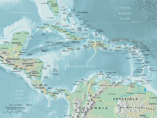
World Route Planner offers an extensive Central America gazetteer, powered by Google Maps, providing detailed Driving Directions and Google Street View across the cities of Central America. Our collaboration with Google Maps delivers the most comprehensive online satellite imagery available, enhancing your exploration of Central America. Our database covers thousands of locations in Central America, categorized by countries, counties, administrative regions, and cities. Additionally, World Route Planner provides precise Time Zones and Daylight maps for Central America. Take advantage of this wealth of information and start exploring Central America with Google Maps today!
Google Maps of Central America
To access Google Street View for any city in Central America, simply drag the yellow pegman icon located above the zoom controls directly onto the map. This will activate the Street View feature, allowing you to explore the streets and landmarks of Central America up close.
Countries in Central America with Google Maps and Gazetteers
Browse the most comprehensive and up-to-date online directory of countries and administrative regions in Central America. Our listings are sorted alphabetically from level 1 to level 2 and up to level 3 regions, ensuring you can easily find specific locations. Integrated with Google Maps and Driving Directions, we provide all the necessary tools to explore Central America. Don't wait—start exploring the unique regions and beautiful countries of Central America today.
The Nature of Politics
Democracy encompasses a wide spectrum of governance practices. In its most robust form, it involves multiparty elections and fair representation. However, in some contexts, such as in Singapore, what is termed democracy can closely resemble single-party rule, where alternative political competition is limited. Conversely, in despotic regimes, power is consolidated in the hands of a single authority, often ruling through personal decree rather than through democratic processes. In such systems, institutions like the parliament and the military typically function as extensions of the dictator's will, rather than as independent entities serving the public.
The Changing World Map
As of 1950, extensive regions globally remained under the dominion of a few European countries. The decolonization process began in Asia post-World War II, where countries in southern and southeastern Asia pursued and achieved self-determination. By the 1960s, numerous African states had gained independence, significantly reducing the scope of European overseas empires by 1965. The final major phase of decolonization occurred with the dissolution of the Soviet Union and the Eastern bloc after 1990. Today, the decolonization process persists as the remaining vestiges of European colonialism, often small island nations, increasingly advocate for independence.
International boundary determinations can be based on various criteria. Borders of older states often follow natural features; others reflect religious and ethnic divides; some are remnants of complicated histories of conflict and colonialism, while others result from international agreements or arbitration.
Post-colonial borders
As European colonial empires in Africa were dismantled in the latter half of the 20th century, the resulting African state borders often replicated the colonial lines. These were drawn by colonial administrators who frequently lacked adequate geographical knowledge, leading to arbitrary divisions among people of different languages, races, religions, and customs. This confused legacy has often resulted in civil and international conflicts.
Physical borders
Many of the world's countries are delineated by physical borders such as lakes, rivers, and mountains. However, demarcating these boundaries can lead to disputes over the control of waterways, water resources, and fisheries, which are common causes of international contention.
International disputes
Today, there are over 60 disputed borders or territories globally. While many of these disputes may be resolved through peaceful negotiations, certain areas have become focal points for international conflicts. Ethnic tensions and the quest for valuable natural resources have historically been significant sources of territorial disputes. The turmoil experienced in parts of Africa during the postcolonial era is partly due to the 19th-century division of the continent, which sowed seeds of conflict by imposing often arbitrary boundaries across linguistic and cultural zones.
Link to Central America Google Maps Page:
Explore our comprehensive map of Central America, which has been viewed 88291 times to date. If you're interested in integrating our Central America map into your website, we offer a seamless method for doing so. Our map includes valuable features such as free Google Maps access, Gazetteer Search, detailed maps of countries and cities, Street View, Driving Directions, and key facts about Central America. Simply copy and paste the HTML code provided below into your website to enhance it with our detailed mapping tools. We appreciate your support and links to World Route Planner!
| Text link to: Central America map and facts page |
This Central America map is provided for informational purposes only. No guarantees are made regarding its accuracy or completeness. Users assume all risks associated with the use of Google Maps and Google Driving Directions. World Route Planner is not responsible for any loss or delays that may occur as a result of using this free Central America map.