 Territory of the Wallis and Futuna Islands Google Maps and Facts
Welcome to the Google Maps of Wallis and Futuna (WF) and the comprehensive location list for this country. World Route Planner, together with its detailed Wallis and Futuna page, turns Google Maps Sightseeing into a meaningful experience! Our extensive destination gazetteer, coupled with Driving Directions to Wallis and Futuna, allows you to explore Wallis and Futuna through detailed satellite imagery and street views—fast, free, and easier than ever before.
Browse through the list of administrative regions in Wallis and Futuna, navigate through these regions to find a place of interest, and book your hotel with the Best Price Guarantee! Your journey through Wallis and Futuna via Google Satellite Map Sightseeing and Street View starts here.
Wallis and Futuna Google Maps
To activate Street View on any city of Wallis and Futuna, drag above the Zoom feature the yellow little man in the map.
Facts about Wallis and Futuna
| Administrative divisions: | none (overseas territory of France); there are no first-order administrative divisions as defined by the US Government , but there are three kingdoms at the second order named Alo , Sigave , Wallis Western Sahara |
| Area: | total: 274 sq km land: 274 sq km water: 0 sq km note: includes Ile Uvea (Wallis Island) , Ile Futuna (Futuna Island) , Ile Alofi , and 20 islets West Bank |
| Background: | The Futuna island group was discovered by the Dutch in 1616 and Wallis by the British in 1767 , but it was the French who declared a protectorate over the islands in 1842. In 1959 , the inhabitants of the islands voted to become a French overseas territory. West Bank |
| Flag description: | unofficial , local flag has a red field with four white isosceles triangles in the middle , representing the three native kings of the islands and the French administrator; the apexes of the triangles are oriented inward and at right angles to each other; the flag of France , outlined in white on two sides , is in the upper hoist quadrant; the flag of France is the only official flag |
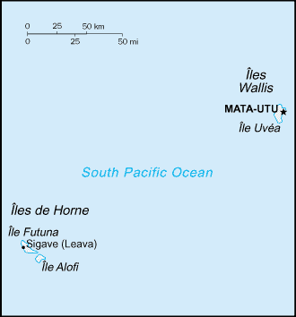
| Capital: | name: Mata-Utu (on Ile Uvea) geographic coordinates: 13 57 S , 171 56 W time difference: UTC+12 (17 hours ahead of Washington , DC during Standard Time) Western Sahara |
| Climate: | tropical; hot , rainy season (November to April); cool , dry season (May to October); rains 2 ,500-3 ,000 mm per year (80% humidity); average temperature 26.6 degrees C West Bank |
| Currency code: | |
| Ethnic groups: | Polynesian West Bank |
| Geographic coordinates: | 13 18 S , 176 12 W West Bank |
| Geography note: | both island groups have fringing reefs West Bank |
| Government type: | NA Western Sahara |
| Imports partners: | France 97% , Australia 2% , NZ 1% (2006) West Bank |
| Internet country code: | .wf West Bank |
| Land boundaries: | 129 km West Bank |
| Neighbouring countries: | 0 km West Bank |
| Languages: | Wallisian 58.9% (indigenous Polynesian language) , Futunian 30.1% , French 10.8% , other 0.2% (2003 census) West Bank |
| Location: | Oceania , islands in the South Pacific Ocean , about two-thirds of the way from Hawaii to New Zealand West Bank |
| Map references: | Oceania West Bank |
| National holiday: | Bastille Day , 14 July (1789) |
| Nationality: | noun: Wallisian(s) , Futunan(s) , or Wallis and Futuna Islanders adjective: Wallisian , Futunan , or Wallis and Futuna Islander West Bank |
| Natural hazards: | NA West Bank |
| Population: | 15 ,237 (July 2008 est.) West Bank |
| Religions: | Roman Catholic 99% , other 1% West Bank |
| Terrain: | volcanic origin; low hills West Bank |
| Unemployment rate: | 15.2% (2003) West Bank |
Capital of Territory of the Wallis and Futuna Islands
[PLACE_CAPITAL] (click to view [PLACE_CAPITAL] map)
Places in Wallis and Futuna
Browse the most comprehensive and up-to-date online directory of administrative regions and Street Views in Wallis and Futuna. Our listings are organized alphabetically, starting from level 1 regions and progressing through to level 2 and eventually level 3 regions, ensuring you can easily navigate and find specific areas of interest.
Akaka city Google Maps
Alele city Google Maps
Alo city Google Maps
Fakauita city Google Maps
Falaleu city Google Maps
Fineveke city Google Maps
Foi city Google Maps
Gahi city Google Maps
Gamua city Google Maps
Haafusia city Google Maps
Haatofo city Google Maps
Halalo city Google Maps
Halamaitai city Google Maps
Kolia city Google Maps
Kolopopo city Google Maps
Liku city Google Maps
Matâ'utu city Google Maps
Mua city Google Maps
Sigavé city Google Maps
Tauai city Google Maps
Teesi city Google Maps
Tepa city Google Maps
Tufuone city Google Maps
Utufua city Google Maps
Utuloa city Google Maps
Vailala city Google Maps
Vaimatau city Google Maps
Vaitupu city Google Maps
Velé city Google Maps
Random cities in Wallis and Futuna
[PLACE_CAPITAL], the capital city of Wallis and Futuna.Alo
Velé
Foi
Halalo
Utuloa
Vaimatau
Liku
Kolopopo
Tepa
Vaitupu
Gamua
Fakauita
Utufua
Haatofo
Akaka
Ahoa
Kolia
Fineveke
Teesi
Link to Wallis and Futuna Google Maps page
The map of Wallis and Futuna has already attracted 2327 views. If you wish to embed our comprehensive Wallis and Futuna map on your site, we offer an easy solution. This map includes free access to Google Maps, gazetteer search, detailed country and city maps, Street View, and essential facts, all ready to enhance your website. To use it, simply copy and paste the provided HTML code into your webpage's source code. We appreciate every link back to our Maps and Driving Directions. Thank you for your support!
| Text link to: Wallis and Futuna map and facts page |
This Wallis and Futuna map is intended solely for informational purposes. No representations or warranties are made concerning its accuracy or reliability. Users assume all risks associated with the use of Google Maps and Google Driving Directions. World Route Planner is not liable for any losses or delays that may occur from using this free Wallis and Futuna map.