 Republic of Mauritius Google Maps and Facts
Welcome to the Google Maps of Mauritius (MU) and the comprehensive location list for this country. World Route Planner, together with its detailed Mauritius page, turns Google Maps Sightseeing into a meaningful experience! Our extensive destination gazetteer, coupled with Driving Directions to Mauritius, allows you to explore Mauritius through detailed satellite imagery and street views—fast, free, and easier than ever before.
Browse through the list of administrative regions in Mauritius, navigate through these regions to find a place of interest, and book your hotel with the Best Price Guarantee! Your journey through Mauritius via Google Satellite Map Sightseeing and Street View starts here.
Mauritius Google Maps
To activate Street View on any city of Mauritius, drag above the Zoom feature the yellow little man in the map.
Facts about Mauritius
| Administrative divisions: | 9 districts and 3 dependencies*; Agalega Islands* , Black River , Cargados Carajos Shoals* , Flacq , Grand Port , Moka , Pamplemousses , Plaines Wilhems , Port Louis , Riviere du Rempart , Rodrigues* , Savanne |
| Area: | total: 2 ,040 sq km land: 2 ,030 sq km water: 10 sq km note: includes Agalega Islands , Cargados Carajos Shoals (Saint Brandon) , and Rodrigues |
| Background: | Although known to Arab and Malay sailors as early as the 10th century , Mauritius was first explored by the Portuguese in the 16th century and subsequently settled by the Dutch - who named it in honor of Prince Maurits van NASSAU - in the 17th century. The French assumed control in 1715 , developing the island into an important naval base overseeing Indian Ocean trade , and establishing a plantation economy of sugar cane. The British captured the island in 1810 , during the Napoleonic Wars. Mauritius remained a strategically important British naval base , and later an air station , playing an important role during World War II for anti-submarine and convoy operations , as well as the collection of signals intelligence. Independence from the UK was attained in 1968. A stable democracy with regular free elections and a positive human rights record , the country has attracted considerable foreign investment and has earned one of Africa's highest per capita incomes. Recent poor weather , declining sugar prices , and declining textile and apparel production , have slowed economic growth , leading to some protests over standards of living in the Creole community. |
| Flag description: | four equal horizontal bands of red (top) , blue , yellow , and green |
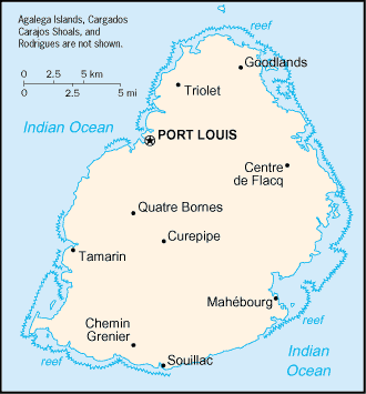
| Capital: | name: Port Louis geographic coordinates: 20 09 S , 57 29 E time difference: UTC+4 (9 hours ahead of Washington , DC during Standard Time) |
| Climate: | tropical , modified by southeast trade winds; warm , dry winter (May to November); hot , wet , humid summer (November to May) |
| Currency code: | Mauritian rupee (MUR) |
| Ethnic groups: | Indo-Mauritian 68% , Creole 27% , Sino-Mauritian 3% , Franco-Mauritian 2% |
| Geographic coordinates: | 20 17 S , 57 33 E |
| Geography note: | the main island , from which the country derives its name , is of volcanic origin and is almost entirely surrounded by coral reefs; home of the dodo , a large flightless bird related to pigeons , driven to extinction by the end of the 17th century through a combination of hunting and the introduction of predatory species |
| Government type: | parliamentary democracy |
| Imports partners: | India 15.3% , France 13.3% , China 7.8% , South Africa 7.4% (2007) |
| Internet country code: | .mu |
| Land boundaries: | 177 km |
| Neighbouring countries: | 0 km |
| Languages: | Creole 80.5% , Bhojpuri 12.1% , French 3.4% , English (official; spoken by less than 1% of the population) , other 3.7% , unspecified 0.3% (2000 census) |
| Location: | Southern Africa , island in the Indian Ocean , east of Madagascar |
| Map references: | Political Map of the World |
| National holiday: | Independence Day , 12 March (1968) |
| Nationality: | noun: Mauritian(s) adjective: Mauritian |
| Natural hazards: | cyclones (November to April); almost completely surrounded by reefs that may pose maritime hazards |
| Population: | 1 ,274 ,189 (July 2008 est.) |
| Religions: | Hindu 48% , Roman Catholic 23.6% , Muslim 16.6% , other Christian 8.6% , other 2.5% , unspecified 0.3% , none 0.4% (2000 census) |
| Terrain: | small coastal plain rising to discontinuous mountains encircling central plateau |
| Unemployment rate: | 8.8% (2007 est.) |
Capital of Republic of Mauritius
Port Louis (click to view Port Louis map)
Places in Mauritius
Browse the most comprehensive and up-to-date online directory of administrative regions and Street Views in Mauritius. Our listings are organized alphabetically, starting from level 1 regions and progressing through to level 2 and eventually level 3 regions, ensuring you can easily navigate and find specific areas of interest.
Black River District (42 google map locations)
Cargados Carajos city Google map
Flacq District (73 google map locations)
Grand Port District (72 google map locations)
Moka District (50 google map locations)
Plaines Wilhems District (58 google map locations)
Port Louis District (18 google map locations)
Rivière du Rempart District (48 google map locations)
Rodrigues (42 google map locations)
Savanne District (42 google map locations)
Random cities in Mauritius
Port Louis, the capital city of Mauritius.Caroline
Les Guibies
Madame Azor
Trou d'Eau Douce
Trèfles
Camp Bonnemère
Moka
Grande Rivière Noire
La Sourdine
Espérance
Camp Sonah
Brisée Verdière
Clémencia
Terracine
Roches Noire
Sebastopol
Grande Pointe aux Piments
Camp Yoloff
Pointe aux Roches
Link to Mauritius Google Maps page
The map of Mauritius has already attracted 8071 views. If you wish to embed our comprehensive Mauritius map on your site, we offer an easy solution. This map includes free access to Google Maps, gazetteer search, detailed country and city maps, Street View, and essential facts, all ready to enhance your website. To use it, simply copy and paste the provided HTML code into your webpage's source code. We appreciate every link back to our Maps and Driving Directions. Thank you for your support!
| Text link to: Mauritius map and facts page |
This Mauritius map is intended solely for informational purposes. No representations or warranties are made concerning its accuracy or reliability. Users assume all risks associated with the use of Google Maps and Google Driving Directions. World Route Planner is not liable for any losses or delays that may occur from using this free Mauritius map.