 Republic of Cape Verde Google Maps and Facts
Welcome to the Google Maps of Cape Verde (CV) and the comprehensive location list for this country. World Route Planner, together with its detailed Cape Verde page, turns Google Maps Sightseeing into a meaningful experience! Our extensive destination gazetteer, coupled with Driving Directions to Cape Verde, allows you to explore Cape Verde through detailed satellite imagery and street views—fast, free, and easier than ever before.
Browse through the list of administrative regions in Cape Verde, navigate through these regions to find a place of interest, and book your hotel with the Best Price Guarantee! Your journey through Cape Verde via Google Satellite Map Sightseeing and Street View starts here.
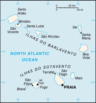
Cape Verde Google Maps
To activate Street View on any city of Cape Verde, drag above the Zoom feature the yellow little man in the map.
Facts about Cape Verde
| Administrative divisions: | 17 municipalities (concelhos , singular - concelho); Boa Vista , Brava , Maio , Mosteiros , Paul , Praia , Porto Novo , Ribeira Grande , Sal , Santa Catarina , Santa Cruz , Sao Domingos , Sao Filipe , Sao Miguel , Sao Nicolau , Sao Vicente , Tarrafal |
| Area: | total: 4 ,033 sq km land: 4 ,033 sq km water: 0 sq km |
| Background: | The uninhabited islands were discovered and colonized by the Portuguese in the 15th century; Cape Verde subsequently became a trading center for African slaves and later an important coaling and resupply stop for whaling and transatlantic shipping. Following independence in 1975 , and a tentative interest in unification with Guinea-Bissau , a one-party system was established and maintained until multi-party elections were held in 1990. Cape Verde continues to exhibit one of Africa's most stable democratic governments. Repeated droughts during the second half of the 20th century caused significant hardship and prompted heavy emigration. As a result , Cape Verde's expatriate population is greater than its domestic one. Most Cape Verdeans have both African and Portuguese antecedents. |
| Flag description: | five unequal horizontal bands; the top-most band of blue - equal to one half the width of the flag - is followed by three bands of white , red , and white , each equal to 1/12 of the width , and a bottom stripe of blue equal to one quarter of the flag width; a circle of 10 , yellow , five-pointed stars , each representing one of the islands , is centered on the red stripe and positioned 3/8 of the length of the flag from the hoist side |
| Capital: | name: Praia geographic coordinates: 14 55 N , 23 31 W time difference: UTC-1 (4 hours ahead of Washington , DC during Standard Time) |
| Climate: | temperate; warm , dry summer; precipitation meager and very erratic |
| Currency code: | Cape Verdean escudo (CVE) |
| Ethnic groups: | Creole (mulatto) 71% , African 28% , European 1% |
| Geographic coordinates: | 16 00 N , 24 00 W |
| Geography note: | strategic location 500 km from west coast of Africa near major north-south sea routes; important communications station; important sea and air refueling site |
| Government type: | republic |
| Imports partners: | Portugal 40.4% , Netherlands 10.9% , France 6.6% , Spain 5.6% , Cote d'Ivoire 4.9% , Italy 4.7% , Brazil 4.5% (2007) |
| Internet country code: | .cv |
| Land boundaries: | 965 km |
| Neighbouring countries: | 0 km |
| Languages: | Portuguese , Crioulo (a blend of Portuguese and West African words) |
| Location: | Western Africa , group of islands in the North Atlantic Ocean , west of Senegal |
| Map references: | Political Map of the World |
| National holiday: | Independence Day , 5 July (1975) |
| Nationality: | noun: Cape Verdean(s) adjective: Cape Verdean |
| Natural hazards: | prolonged droughts; seasonal harmattan wind produces obscuring dust; volcanically and seismically active |
| Population: | 426 ,998 (July 2008 est.) |
| Religions: | Roman Catholic (infused with indigenous beliefs) , Protestant (mostly Church of the Nazarene) |
| Terrain: | steep , rugged , rocky , volcanic |
| Unemployment rate: | 21% (2000 est.) |
Capital of Republic of Cape Verde
Praia (click to view Praia map)
Places in Cape Verde
Browse the most comprehensive and up-to-date online directory of administrative regions and Street Views in Cape Verde. Our listings are organized alphabetically, starting from level 1 regions and progressing through to level 2 and eventually level 3 regions, ensuring you can easily navigate and find specific areas of interest.
Baboso city Google map
Baluarte city Google map
Bonita city Google map
Botija city Google map
Cachaço city Google map
Chã da Ribeira city Google map
Chã do Morto city Google map
Chã do Norte city Google map
Chão Queimado city Google map
Círio city Google map
Concelho da Boa Vista (21 google map locations)
Concelho da Brava (10 google map locations)
Concelho da Praia (20 google map locations)
Concelho da Ribeira Grande (35 google map locations)
Concelho de Santa Catarina (5 google map locations)
Concelho de Santa Cruz city Google map
Concelho de São Domingos (1 google map locations)
Concelho de São Filipe (18 google map locations)
Concelho de São Miguel city Google map
Concelho de São Nicolau (27 google map locations)
Concelho de São Vicente (12 google map locations)
Concelho do Maio (13 google map locations)
Concelho do Paul city Google map
Concelho do Sal (14 google map locations)
Concelho do Tarrafal (26 google map locations)
Curral das Vacas city Google map
Galinheiro city Google map
João Daninha city Google map
Leiro city Google map
Lombo da Torre city Google map
Lombo das Danças city Google map
Martiana city Google map
Miguel Pires city Google map
Morrinho city Google map
Morrinho d' Égua city Google map
Pedrinha city Google map
Pinto city Google map
Porto Novo city Google map
Queimado city Google map
Ribeira da Cruz city Google map
Ribeira Fria city Google map
Ribeira Vermelha city Google map
São Jorge city Google map
Selada city Google map
Seladinha city Google map
Tabuadinha city Google map
Tabuga city Google map
Tarrafal city Google map
Urzeleiro city Google map
Random cities in Cape Verde
Praia, the capital city of Cape Verde.Pinchossa
Relva
Cova Figueira
Corvo
Porto Gouveia
Beirona
Lagoa
Camarões
Ponta da Cruz
Achada Grande
Santa Maria
Areia Branca
Lazareto
Baleia
Escabeçada de Baixo
Mão para Trás
Cachaço
Tongon
Pai Amaro
Link to Cape Verde Google Maps page
The map of Cape Verde has already attracted 4926 views. If you wish to embed our comprehensive Cape Verde map on your site, we offer an easy solution. This map includes free access to Google Maps, gazetteer search, detailed country and city maps, Street View, and essential facts, all ready to enhance your website. To use it, simply copy and paste the provided HTML code into your webpage's source code. We appreciate every link back to our Maps and Driving Directions. Thank you for your support!
| Text link to: Cape Verde map and facts page |
This Cape Verde map is intended solely for informational purposes. No representations or warranties are made concerning its accuracy or reliability. Users assume all risks associated with the use of Google Maps and Google Driving Directions. World Route Planner is not liable for any losses or delays that may occur from using this free Cape Verde map.