 United States Virgin Islands Google Maps and Facts
Welcome to the Google Maps of Virgin Islands (VI) and the comprehensive location list for this country. World Route Planner, together with its detailed Virgin Islands page, turns Google Maps Sightseeing into a meaningful experience! Our extensive destination gazetteer, coupled with Driving Directions to Virgin Islands, allows you to explore Virgin Islands through detailed satellite imagery and street views—fast, free, and easier than ever before.
Browse through the list of administrative regions in Virgin Islands, navigate through these regions to find a place of interest, and book your hotel with the Best Price Guarantee! Your journey through Virgin Islands via Google Satellite Map Sightseeing and Street View starts here.
Virgin Islands Google Maps
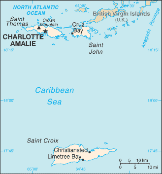
To activate Street View on any city of Virgin Islands, drag above the Zoom feature the yellow little man in the map.
Facts about Virgin Islands
| Administrative divisions: | none (territory of the US); there are no first-order administrative divisions as defined by the US Government , but there are three islands at the second order; Saint Croix , Saint John , Saint Thomas |
| Area: | total: 1 ,910 sq km land: 346 sq km water: 1 ,564 sq km Wake Island |
| Background: | During the 17th century , the archipelago was divided into two territorial units , one English and the other Danish. Sugarcane , produced by slave labor , drove the islands' economy during the 18th and early 19th centuries. In 1917 , the US purchased the Danish portion , which had been in economic decline since the abolition of slavery in 1848. Wake Island |
| Flag description: | white field with a modified US coat of arms in the center between the large blue initials V and I; the coat of arms shows a yellow eagle holding an olive branch in one talon and three arrows in the other with a superimposed shield of vertical red and white stripes below a blue panel Wake Island |
| Capital: | name: Charlotte Amalie geographic coordinates: 18 21 N , 64 56 W time difference: UTC-4 (1 hour ahead of Washington , DC during Standard Time) |
| Climate: | subtropical , tempered by easterly trade winds , relatively low humidity , little seasonal temperature variation; rainy season September to November Wake Island |
| Currency code: | |
| Ethnic groups: | black 76.2% , white 13.1% , Asian 1.1% , other 6.1% , mixed 3.5% (2000 census) |
| Geographic coordinates: | 18 20 N , 64 50 W Wake Island |
| Geography note: | important location along the Anegada Passage - a key shipping lane for the Panama Canal; Saint Thomas has one of the best natural deepwater harbors in the Caribbean Wake Island |
| Government type: | NA |
| Imports partners: | US , Puerto Rico (2006) |
| Internet country code: | .vi |
| Land boundaries: | 188 km Wake Island |
| Neighbouring countries: | 0 km Wake Island |
| Languages: | English 74.7% , Spanish or Spanish Creole 16.8% , French or French Creole 6.6% , other 1.9% (2000 census) |
| Location: | Caribbean , islands between the Caribbean Sea and the North Atlantic Ocean , east of Puerto Rico Wake Island |
| Map references: | Central America and the Caribbean Wake Island |
| National holiday: | Transfer Day (from Denmark to the US) , 31 March (1917) |
| Nationality: | noun: Virgin Islander(s) (US citizens) adjective: Virgin Islander |
| Natural hazards: | several hurricanes in recent years; frequent and severe droughts and floods; occasional earthquakes Wake Island |
| Population: | 109 ,840 (July 2008 est.) Wake Island |
| Religions: | Baptist 42% , Roman Catholic 34% , Episcopalian 17% , other 7% |
| Terrain: | mostly hilly to rugged and mountainous with little level land Wake Island |
| Unemployment rate: | 6.2% (2004) |
Capital of United States Virgin Islands
[PLACE_CAPITAL] (click to view [PLACE_CAPITAL] map)
Places in Virgin Islands
Browse the most comprehensive and up-to-date online directory of administrative regions and Street Views in Virgin Islands. Our listings are organized alphabetically, starting from level 1 regions and progressing through to level 2 and eventually level 3 regions, ensuring you can easily navigate and find specific areas of interest.
Adrian city Google map
Allandale city Google map
Altona city Google map
Anguilla city Google map
Annaberg city Google map
Annaly city Google map
Annas Hope city Google map
Barrett city Google map
Beck Grove city Google map
Beeston Hill city Google map
Bellevue city Google map
Belvedere city Google map
Benner city Google map
Bethany city Google map
Bethlehem Old Work city Google map
Bettys Hope city Google map
Betzys Jewell city Google map
Blessing city Google map
Bodkin city Google map
Bolongo city Google map
Bonne Esperance city Google map
Bordeaux city Google map
Bovoni city Google map
Bugbyhole city Google map
Bulows Minde city Google map
Butler Bay city Google map
Butzberg city Google map
Cabritaberg city Google map
Calabash Boom city Google map
Camporico city Google map
Canaan city Google map
Cane city Google map
Cane Valley city Google map
Canebay city Google map
Carden city Google map
Caret Bay Estate city Google map
Carlton city Google map
Carolina city Google map
Castle Coakley city Google map
Catharinas Hope city Google map
Cathrines Rest city Google map
Charlotte Amalie city Google map
Christiansted city Google map
Clairmont city Google map
Clifton Hill city Google map
Coble city Google map
Concordia city Google map
Contant city Google map
Contentment city Google map
Cooper city Google map
Coral Bay city Google map
Cotton Grove city Google map
Cotton Valley city Google map
Cowell Battery city Google map
Cruz Bay city Google map
Diamond city Google map
Diamond Keturah city Google map
Donoe city Google map
Dorothea city Google map
East End city Google map
Emmaus city Google map
Enighed city Google map
Ensomned city Google map
Envy city Google map
Estate Thomas city Google map
Fareham city Google map
Fish Bay city Google map
Fort Christian city Google map
Fort Frederick city Google map
Fountain city Google map
Fredensborg city Google map
Fredensdal city Google map
Frederiks Haab city Google map
Frederiksted city Google map
Fredriksdal city Google map
Frenchtown city Google map
Friedensfeld city Google map
Frydendal city Google map
Glynn city Google map
Golden Grove city Google map
Good Hope city Google map
Granard city Google map
Grange city Google map
Great Pond city Google map
Green Kay city Google map
Grove Place city Google map
Hams Bay city Google map
Hard Labour city Google map
Hermitage city Google map
Hesselberg city Google map
Hoffman city Google map
Hogensborg city Google map
Hope city Google map
Humbug city Google map
Jealousy city Google map
Jerusalem and Figtree Hill city Google map
John Oley city Google map
Johns Folly city Google map
Jolly Hill city Google map
Kingshill city Google map
Knight city Google map
La Grande Princesse city Google map
La Reine city Google map
La Vallee city Google map
Lameshur city Google map
Laprey Valley city Google map
Leinster Bay city Google map
Lerkenlund city Google map
Libanon Hill city Google map
Lilliendahl city Google map
Limetree city Google map
Little Fountain city Google map
Longford city Google map
Louisenhoj city Google map
Lovenlund city Google map
Lower Love city Google map
Lowrys Hill city Google map
L'Esperance city Google map
Madame Carty city Google map
Mafolie city Google map
Mandal city Google map
Mariendal city Google map
Mary Point city Google map
Misgen city Google map
Mollendal city Google map
Mon Bijou city Google map
Monte city Google map
Montpellier city Google map
Morningstar city Google map
Mount Pleasant city Google map
Munster city Google map
Nadir city Google map
Nazareth city Google map
Negro Bay city Google map
Neltjeberg city Google map
Nicholas city Google map
North Side city Google map
North Star city Google map
Nugent city Google map
Orange Grove city Google map
Orangegrove city Google map
Oxford city Google map
Palestina city Google map
Paradise city Google map
Parasol city Google map
Pearl city Google map
Pearson Gardens city Google map
Peterborg city Google map
Peters Rest city Google map
Petronella city Google map
Pleasant Vale city Google map
Plessen city Google map
Profit city Google map
Prosperity city Google map
Punch city Google map
Raphune city Google map
Rattan and Belvedere city Google map
Recovery Hill city Google map
Reef Bay city Google map
Resolution city Google map
Richmond city Google map
Robe Hill city Google map
Rosendal city Google map
Ruan Bay city Google map
Ruby city Google map
Ryan city Google map
Saint John city Google map
Saint Peter city Google map
Sallys Fancy city Google map
Sandy Point city Google map
Santa Maria Estate city Google map
Seven Hills city Google map
Shoys city Google map
Sieben city Google map
Sion Farm city Google map
Sion Hill city Google map
Slob city Google map
Smithfield city Google map
Solberg city Google map
Solitude city Google map
Sorgenfri city Google map
Southgate city Google map
Spanish Town city Google map
Sprat Hall Beach city Google map
Springfield city Google map
Strawberry Hill city Google map
Sunny Isle city Google map
Susannaberg city Google map
Teagues Bay city Google map
Testman city Google map
Tutu city Google map
Two Brothers city Google map
Upper Bethlehem city Google map
Upper Love city Google map
Waldberggaard city Google map
Wheel of Fortune city Google map
Whim city Google map
Whites Bay city Google map
William city Google map
Williams Delight city Google map
Windberg city Google map
Windsor city Google map
Zambee city Google map
Random cities in Virgin Islands
[PLACE_CAPITAL], the capital city of Virgin Islands.Caret Bay Estate
Bonne Esperance
Parasol
Coble
Adelphi
Cotton Valley
Mandal
Green Kay
Zambee
Concordia
Butler Bay
Cowell Battery
Altona
Morningstar
Anguilla
Lerkenlund
Longford
Misgen
Profit
Link to Virgin Islands Google Maps page
The map of Virgin Islands has already attracted 2609 views. If you wish to embed our comprehensive Virgin Islands map on your site, we offer an easy solution. This map includes free access to Google Maps, gazetteer search, detailed country and city maps, Street View, and essential facts, all ready to enhance your website. To use it, simply copy and paste the provided HTML code into your webpage's source code. We appreciate every link back to our Maps and Driving Directions. Thank you for your support!
| Text link to: Virgin Islands map and facts page |
This Virgin Islands map is intended solely for informational purposes. No representations or warranties are made concerning its accuracy or reliability. Users assume all risks associated with the use of Google Maps and Google Driving Directions. World Route Planner is not liable for any losses or delays that may occur from using this free Virgin Islands map.