 Republic of Vanuatu Google Maps and Facts
Welcome to the Google Maps of Vanuatu (VU) and the comprehensive location list for this country. World Route Planner, together with its detailed Vanuatu page, turns Google Maps Sightseeing into a meaningful experience! Our extensive destination gazetteer, coupled with Driving Directions to Vanuatu, allows you to explore Vanuatu through detailed satellite imagery and street views—fast, free, and easier than ever before.
Browse through the list of administrative regions in Vanuatu, navigate through these regions to find a place of interest, and book your hotel with the Best Price Guarantee! Your journey through Vanuatu via Google Satellite Map Sightseeing and Street View starts here.
Vanuatu Google Maps
To activate Street View on any city of Vanuatu, drag above the Zoom feature the yellow little man in the map.
Facts about Vanuatu
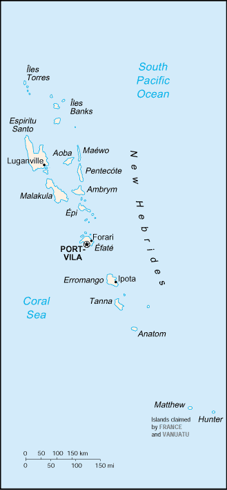
| Administrative divisions: | 6 provinces; Malampa , Penama , Sanma , Shefa , Tafea , Torba |
| Area: | total: 12 ,200 sq km land: 12 ,200 sq km water: 0 sq km note: includes more than 80 islands , about 65 of which are inhabited |
| Background: | Multiple waves of colonizers , each speaking a distinct language , migrated to the New Hebrides in the millennia preceding European exploration in the 18th century. This settlement pattern accounts for the complex linguistic diversity found on the archipelago to this day. The British and French , who settled the New Hebrides in the 19th century , agreed in 1906 to an Anglo-French Condominium , which administered the islands until independence in 1980 , when the new name of Vanuatu was adopted. |
| Flag description: | two equal horizontal bands of red (top) and green with a black isosceles triangle (based on the hoist side) all separated by a black-edged yellow stripe in the shape of a horizontal Y (the two points of the Y face the hoist side and enclose the triangle); centered in the triangle is a boar's tusk encircling two crossed namele leaves , all in yellow |
| Capital: | name: Port-Vila (on Efate) geographic coordinates: 17 44 S , 168 19 E time difference: UTC+11 (16 hours ahead of Washington , DC during Standard Time) |
| Climate: | tropical; moderated by southeast trade winds from May to October; moderate rainfall from November to April; may be affected by cyclones from December to April |
| Currency code: | |
| Ethnic groups: | Ni-Vanuatu 98.5% , other 1.5% (1999 Census) |
| Geographic coordinates: | 16 00 S , 167 00 E |
| Geography note: | a Y-shaped chain of four main islands and 80 smaller islands; several of the islands have active volcanoes |
| Government type: | parliamentary republic |
| Imports partners: | Australia 20.7% , Singapore 12% , NZ 11.3% , Norway 8.6% , US 8.4% , Fiji 8.2% , China 7.3% , New Caledonia 4.6% (2007) |
| Internet country code: | .vu |
| Land boundaries: | 2 ,528 km |
| Neighbouring countries: | 0 km |
| Languages: | local languages (more than 100) 72.6% , pidgin (known as Bislama or Bichelama) 23.1% , English 1.9% , French 1.4% , other 0.3% , unspecified 0.7% (1999 Census) |
| Location: | Oceania , group of islands in the South Pacific Ocean , about three-quarters of the way from Hawaii to Australia |
| Map references: | Oceania |
| National holiday: | Independence Day , 30 July (1980) |
| Nationality: | noun: Ni-Vanuatu (singular and plural) adjective: Ni-Vanuatu |
| Natural hazards: | tropical cyclones or typhoons (January to April); volcanic eruption on Aoba (Ambae) island began 27 November 2005 , volcanism also causes minor earthquakes; tsunamis |
| Population: | 215 ,446 (July 2008 est.) |
| Religions: | Presbyterian 31.4% , Anglican 13.4% , Roman Catholic 13.1% , Seventh-Day Adventist 10.8% , other Christian 13.8% , indigenous beliefs 5.6% (including Jon Frum cargo cult) , other 9.6% , none 1% , unspecified 1.3% (1999 Census) |
| Terrain: | mostly mountainous islands of volcanic origin; narrow coastal plains |
| Unemployment rate: | 1.7% (1999) |
Capital of Republic of Vanuatu
Port-Vila (click to view Port-Vila map)
Places in Vanuatu
Browse the most comprehensive and up-to-date online directory of administrative regions and Street Views in Vanuatu. Our listings are organized alphabetically, starting from level 1 regions and progressing through to level 2 and eventually level 3 regions, ensuring you can easily navigate and find specific areas of interest.
Penama Province (140 Google Maps locations)
Pentecôte (149 Google Maps locations)
Sanma Province (305 Google Maps locations)
Shepherd (29 Google Maps locations)
Tafea Province (170 Google Maps locations)
Torba Province (69 Google Maps locations)
Random cities in Vanuatu
Port-Vila, the capital city of Vanuatu.Pangona
Sounaï
Nokonsédé
Kaounoméikeur
Taoumanouni
Piloé
Pesia
Ignal
Assourou
Likalia
Morgrif
Langrom̄os
Ikounala
Paten
Avatouna
Manpay
Olasi
Itounga
Fortsenal
Link to Vanuatu Google Maps page
The map of Vanuatu has already attracted 4037 views. If you wish to embed our comprehensive Vanuatu map on your site, we offer an easy solution. This map includes free access to Google Maps, gazetteer search, detailed country and city maps, Street View, and essential facts, all ready to enhance your website. To use it, simply copy and paste the provided HTML code into your webpage's source code. We appreciate every link back to our Maps and Driving Directions. Thank you for your support!
| Text link to: Vanuatu map and facts page |
This Vanuatu map is intended solely for informational purposes. No representations or warranties are made concerning its accuracy or reliability. Users assume all risks associated with the use of Google Maps and Google Driving Directions. World Route Planner is not liable for any losses or delays that may occur from using this free Vanuatu map.