 Kingdom of Norway Google Maps and Facts
Welcome to the Google Maps of Norway (NO) and the comprehensive location list for this country. World Route Planner, together with its detailed Norway page, turns Google Maps Sightseeing into a meaningful experience! Our extensive destination gazetteer, coupled with Driving Directions to Norway, allows you to explore Norway through detailed satellite imagery and street views—fast, free, and easier than ever before.
Browse through the list of administrative regions in Norway, navigate through these regions to find a place of interest, and book your hotel with the Best Price Guarantee! Your journey through Norway via Google Satellite Map Sightseeing and Street View starts here.
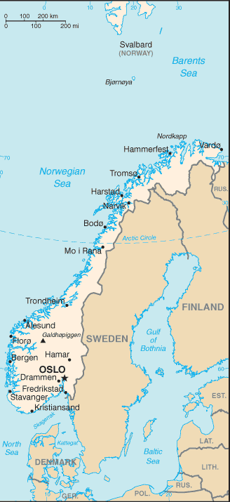
Norway Google Maps
To activate Street View on any city of Norway, drag above the Zoom feature the yellow little man in the map.
Facts about Norway
| Administrative divisions: | 19 counties (fylker , singular - fylke); Akershus , Aust-Agder , Buskerud , Finnmark , Hedmark , Hordaland , More og Romsdal , Nordland , Nord-Trondelag , Oppland , Oslo , Ostfold , Rogaland , Sogn og Fjordane , Sor-Trondelag , Telemark , Troms , Vest-Agder , Vestfold |
| Area: | total: 323 ,802 sq km land: 307 ,442 sq km water: 16 ,360 sq km |
| Background: | Two centuries of Viking raids into Europe tapered off following the adoption of Christianity by King Olav TRYGGVASON in 994. Conversion of the Norwegian kingdom occurred over the next several decades. In 1397 , Norway was absorbed into a union with Denmark that lasted more than four centuries. In 1814 , Norwegians resisted the cession of their country to Sweden and adopted a new constitution. Sweden then invaded Norway but agreed to let Norway keep its constitution in return for accepting the union under a Swedish king. Rising nationalism throughout the 19th century led to a 1905 referendum granting Norway independence. Although Norway remained neutral in World War I , it suffered heavy losses to its shipping. Norway proclaimed its neutrality at the outset of World War II , but was nonetheless occupied for five years by Nazi Germany (1940-45). In 1949 , neutrality was abandoned and Norway became a member of NATO. Discovery of oil and gas in adjacent waters in the late 1960s boosted Norway's economic fortunes. The current focus is on containing spending on the extensive welfare system and planning for the time when petroleum reserves are depleted. In referenda held in 1972 and 1994 , Norway rejected joining the EU. |
| Flag description: | red with a blue cross outlined in white that extends to the edges of the flag; the vertical part of the cross is shifted to the hoist side in the style of the Dannebrog (Danish flag) |
| Capital: | name: Oslo geographic coordinates: 59 55 N , 10 45 E time difference: UTC+1 (6 hours ahead of Washington , DC during Standard Time) daylight saving time: +1hr , begins last Sunday in March; ends last Sunday in October |
| Climate: | temperate along coast , modified by North Atlantic Current; colder interior with increased precipitation and colder summers; rainy year-round on west coast |
| Currency code: | Norwegian krone (NOK) |
| Ethnic groups: | Norwegian 94.4% (includes Sami , about 60 ,000) , other European 3.6% , other 2% (2007 estimate) |
| Geographic coordinates: | 62 00 N , 10 00 E |
| Geography note: | about two-thirds mountains; some 50 ,000 islands off its much indented coastline; strategic location adjacent to sea lanes and air routes in North Atlantic; one of most rugged and longest coastlines in the world |
| Government type: | constitutional monarchy |
| Imports partners: | Sweden 14.7% , Germany 13.6% , UK 6.9% , Denmark 6.4% , China 6.1% , US 4.8% , Canada 4.3% (2007) |
| Internet country code: | .no |
| Land boundaries: | 25 ,148 km (includes mainland 2 ,650 km , as well as long fjords , numerous small islands , and minor indentations 22 ,498 km; length of island coastlines 58 ,133 km) |
| Neighbouring countries: | total: 2 ,542 km border countries: Finland 727 km , Sweden 1 ,619 km , Russia 196 km |
| Languages: | Bokmal Norwegian (official) , Nynorsk Norwegian (official) , small Sami- and Finnish-speaking minorities; note - Sami is official in six municipalities |
| Location: | Northern Europe , bordering the North Sea and the North Atlantic Ocean , west of Sweden |
| Map references: | Europe |
| National holiday: | Constitution Day , 17 May (1814) |
| Nationality: | noun: Norwegian(s) adjective: Norwegian |
| Natural hazards: | rockslides , avalanches |
| Population: | 4 ,644 ,457 (July 2008 est.) |
| Religions: | Church of Norway 85.7% , Pentecostal 1% , Roman Catholic 1% , other Christian 2.4% , Muslim 1.8% , other 8.1% (2004) |
| Terrain: | glaciated; mostly high plateaus and rugged mountains broken by fertile valleys; small , scattered plains; coastline deeply indented by fjords; arctic tundra in north |
| Unemployment rate: | 2.5% (2007 est.) |
Capital of Kingdom of Norway
Oslo (click to view Oslo map)
Places in Norway
Browse the most comprehensive and up-to-date online directory of administrative regions and Street Views in Norway. Our listings are organized alphabetically, starting from level 1 regions and progressing through to level 2 and eventually level 3 regions, ensuring you can easily navigate and find specific areas of interest.
Aust-Agder County (291 Google Maps locations)
Buskerud County (296 Google Maps locations)
City and County of Oslo (38 Google Maps locations)
Finnmark County (322 Google Maps locations)
Hedmark County (425 Google Maps locations)
Hordaland County (932 Google Maps locations)
More og Romsdal County (441 Google Maps locations)
Nord-Trondelag County (432 Google Maps locations)
Nordland County (1095 Google Maps locations)
Ostfold County (142 Google Maps locations)
Rogaland County (466 Google Maps locations)
Sogn og Fjordane County (607 Google Maps locations)
Sor-Trondelag County (579 Google Maps locations)
Telemark County (414 Google Maps locations)
Troms County (706 Google Maps locations)
Vest-Agder County (392 Google Maps locations)
Vestfold County (159 Google Maps locations)
Random cities in Norway
Oslo, the capital city of Norway.Raufoss
Solberg
Selvær
Flekkos
Systad
Veggja
Espeland
Sjursmoen
Hovde
Trisett
Skasenden
Gulsvåg
Skjelfoss
Mettevoll
Utsikten
Heimsnes
Vebenstad
Vinknes
Kylles
Link to Norway Google Maps page
The map of Norway has already attracted 10622 views. If you wish to embed our comprehensive Norway map on your site, we offer an easy solution. This map includes free access to Google Maps, gazetteer search, detailed country and city maps, Street View, and essential facts, all ready to enhance your website. To use it, simply copy and paste the provided HTML code into your webpage's source code. We appreciate every link back to our Maps and Driving Directions. Thank you for your support!
| Text link to: Norway map and facts page |
This Norway map is intended solely for informational purposes. No representations or warranties are made concerning its accuracy or reliability. Users assume all risks associated with the use of Google Maps and Google Driving Directions. World Route Planner is not liable for any losses or delays that may occur from using this free Norway map.