 Democratic Republic of the Congo Google Maps and Facts
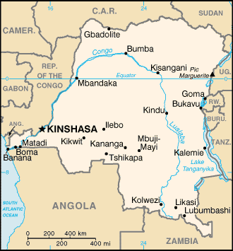
Map of Congo, Democratic Republic of the ⇣ | Google Maps of Congo, Democratic Republic of the ⇣ | All Places in Congo, Democratic Republic of the ⇣
Welcome to the Google Maps of Congo, Democratic Republic of the (CD) and the comprehensive location list for this country. World Route Planner, together with its detailed Congo, Democratic Republic of the page, turns Google Maps Sightseeing into a meaningful experience! Our extensive destination gazetteer, coupled with Driving Directions to Congo, Democratic Republic of the, allows you to explore Congo, Democratic Republic of the through detailed satellite imagery and street views—fast, free, and easier than ever before.
Browse through the list of administrative regions in Congo, Democratic Republic of the, navigate through these regions to find a place of interest, and book your hotel with the Best Price Guarantee! Your journey through Congo, Democratic Republic of the via Google Satellite Map Sightseeing and Street View starts here.
Congo, Democratic Republic of the Google Maps
To activate Street View on any city of Congo, Democratic Republic of the, drag above the Zoom feature the yellow little man in the map.
Facts about Congo, Democratic Republic of the
| Administrative divisions: | 10 provinces (provinces , singular - province) and 1 city* (ville); Bandundu , Bas-Congo , Equateur , Kasai-Occidental , Kasai-Oriental , Katanga , Kinshasa* , Maniema , Nord-Kivu , Orientale , Sud-Kivu note: according to the Constitution adopted in December 2005 , the current administrative divisions will be subdivided into 26 new provinces by 2009 |
| Area: | total: 2 ,345 ,410 sq km land: 2 ,267 ,600 sq km water: 77 ,810 sq km |
| Background: | Established as a Belgian colony in 1908 , the Republic of the Congo gained its independence in 1960 , but its early years were marred by political and social instability. Col. Joseph MOBUTU seized power and declared himself president in a November 1965 coup. He subsequently changed his name - to MOBUTU Sese Seko - as well as that of the country - to Zaire. MOBUTU retained his position for 32 years through several sham elections , as well as through the use of brutal force. Ethnic strife and civil war , touched off by a massive inflow of refugees in 1994 from fighting in Rwanda and Burundi , led in May 1997 to the toppling of the MOBUTU regime by a rebellion backed by Rwanda and Uganda and fronted by Laurent KABILA. He renamed the country the Democratic Republic of the Congo (DRC) , but in August 1998 his regime was itself challenged by a second insurrection again backed by Rwanda and Uganda. Troops from Angola , Chad , Namibia , Sudan , and Zimbabwe intervened to support KABILA's regime. A cease-fire was signed in July 1999 by the DRC , Congolese armed rebel groups , Angola , Namibia , Rwanda , Uganda , and Zimbabwe but sporadic fighting continued. Laurent KABILA was assassinated in January 2001 and his son , Joseph KABILA , was named head of state. In October 2002 , the new president was successful in negotiating the withdrawal of Rwandan forces occupying eastern Congo; two months later , the Pretoria Accord was signed by all remaining warring parties to end the fighting and establish a government of national unity. A transitional government was set up in July 2003. Joseph KABILA as president and four vice presidents represented the former government , former rebel groups , the political opposition , and civil society. The transitional government held a successful constitutional referendum in December 2005 and elections for the presidency , National Assembly , and provincial legislatures in 2006. KABILA was inaugurated president in December 2006. The National Assembly was installed in September 2006. Its president , Vital KAMERHE , was chosen in December. Provincial assemblies were constituted in early 2007 , and elected governors and national senators in January 2007. |
| Flag description: | sky blue field divided diagonally from the lower hoist corner to upper fly corner by a red stripe bordered by two narrow yellow stripes; a yellow , five-pointed star appears in the upper hoist corner |
| Capital: | name: Kinshasa geographic coordinates: 4 19 S , 15 18 E time difference: UTC+1 (six hours ahead of Washington , DC during Standard Time) |
| Climate: | tropical; hot and humid in equatorial river basin; cooler and drier in southern highlands; cooler and wetter in eastern highlands; north of Equator - wet season (April to October) , dry season (December to February); south of Equator - wet season (November to March) , dry season (April to October) |
| Currency code: | Congolese franc (CDF) |
| Ethnic groups: | over 200 African ethnic groups of which the majority are Bantu; the four largest tribes - Mongo , Luba , Kongo (all Bantu) , and the Mangbetu-Azande (Hamitic) make up about 45% of the population |
| Geographic coordinates: | 0 00 N , 25 00 E |
| Geography note: | straddles equator; has narrow strip of land that controls the lower Congo River and is only outlet to South Atlantic Ocean; dense tropical rain forest in central river basin and eastern highlands |
| Government type: | republic |
| Imports partners: | South Africa 22.2% , Belgium 10.1% , Zambia 8.8% , Zimbabwe 7.3% , France 6.7% , Kenya 6.2% , US 4% , Cote d'Ivoire 4% (2007) |
| Internet country code: | .cd |
| Land boundaries: | 37 km |
| Neighbouring countries: | total: 10 ,730 km border countries: Angola 2 ,511 km (of which 225 km is the boundary of Angola's discontiguous Cabinda Province) , Burundi 233 km , Central African Republic 1 ,577 km , Republic of the Congo 2 ,410 km , Rwanda 217 km , Sudan 628 km , Tanzania 459 km , Uganda 765 km , Zambia 1 ,930 km |
| Languages: | French (official) , Lingala (a lingua franca trade language) , Kingwana (a dialect of Kiswahili or Swahili) , Kikongo , Tshiluba |
| Location: | Central Africa , northeast of Angola |
| Map references: | Africa |
| National holiday: | Independence Day , 30 June (1960) |
| Nationality: | noun: Congolese (singular and plural) adjective: Congolese or Congo |
| Natural hazards: | periodic droughts in south; Congo River floods (seasonal); in the east , in the Great Rift Valley , there are active volcanoes |
| Population: | 66 ,514 ,504 note: estimates for this country explicitly take into account the effects of excess mortality due to AIDS; this can result in lower life expectancy , higher infant mortality , higher death rates , lower population growth rates , and changes in the distribution of population by age and sex than would otherwise be expected (July 2008 est.) |
| Religions: | Roman Catholic 50% , Protestant 20% , Kimbanguist 10% , Muslim 10% , other (includes syncretic sects and indigenous beliefs) 10% |
| Terrain: | vast central basin is a low-lying plateau; mountains in east |
| Unemployment rate: | NA% |
Capital of Democratic Republic of the Congo
Kinshasa (click to view Kinshasa map)
Places in Congo, Democratic Republic of the
Browse the most comprehensive and up-to-date online directory of administrative regions and Street Views in Congo, Democratic Republic of the. Our listings are organized alphabetically, starting from level 1 regions and progressing through to level 2 and eventually level 3 regions, ensuring you can easily navigate and find specific areas of interest.
Bas-Congo Province (862 Google Maps locations)
Équateur Province (2961 Google Maps locations)
Kasaï- Province (1621 Google Maps locations)
Kasaï-Occidental Province (1353 Google Maps locations)
Katanga Province (3042 Google Maps locations)
Maniema Province (1077 Google Maps locations)
Nord-Kivu Province (641 Google Maps locations)
Orientale Province (3347 Google Maps locations)
Sud-Kivu Province (609 Google Maps locations)
Random cities in Congo, Democratic Republic of the
Kinshasa, the capital city of Congo, Democratic Republic of the.Yakumi
Banda
Wolikombo I
Shayingona
Sedi
Mpio
Kitsako-Moanda
Bankoko II
Mayoko
Kangumba
Gongo
Pompombo-Rive
Masele-Intsumu
Dimbu
Ditu
Mutwanga
Lunea
Yangi
Bobabili
Link to Congo, Democratic Republic of the Google Maps page
The map of Congo, Democratic Republic of the has already attracted 8918 views. If you wish to embed our comprehensive Congo, Democratic Republic of the map on your site, we offer an easy solution. This map includes free access to Google Maps, gazetteer search, detailed country and city maps, Street View, and essential facts, all ready to enhance your website. To use it, simply copy and paste the provided HTML code into your webpage's source code. We appreciate every link back to our Maps and Driving Directions. Thank you for your support!
| Text link to: Congo, Democratic Republic of the map and facts page |
This Congo, Democratic Republic of the map is intended solely for informational purposes. No representations or warranties are made concerning its accuracy or reliability. Users assume all risks associated with the use of Google Maps and Google Driving Directions. World Route Planner is not liable for any losses or delays that may occur from using this free Congo, Democratic Republic of the map.