 Republic of Hungary Google Maps and Facts
Welcome to the Google Maps of Hungary (HU) and the comprehensive location list for this country. World Route Planner, together with its detailed Hungary page, turns Google Maps Sightseeing into a meaningful experience! Our extensive destination gazetteer, coupled with Driving Directions to Hungary, allows you to explore Hungary through detailed satellite imagery and street views—fast, free, and easier than ever before.
Browse through the list of administrative regions in Hungary, navigate through these regions to find a place of interest, and book your hotel with the Best Price Guarantee! Your journey through Hungary via Google Satellite Map Sightseeing and Street View starts here.
That Budapest - one of the most beautiful cities in the world – has developed where it is, is not down to some historical accident. Take a look at Gellért Hill, right next to the River Danube as it flows majestically through the centre of the modern city. It was precisely the combination of the relative ease of crossing the River here and the natural protection the hill offered against invasion that decided the earliest settlers it was the ideal place to build a town. The Eravisci, a tribe of highly cultured Celts, had already settled at Gellért Hill in the third and fourth centuries B.C. They worked with iron, decorated their earthenware pots and even minted their own coins. Later, the Romans built a settlement at today’s Óbuda. They called it Aquincum and it was an important station along the limes which ran alongside the River Danube.Hungary Google Maps
To activate Street View on any city of Hungary, drag above the Zoom feature the yellow little man in the map.
And there are others still who enjoy shopping and sitting in cafés. In Budapest there is all this, and much more besides. From morning till night the parks (particularly the Margaret Island) are full of joggers. There are popular cycle paths springing up. The little lake in City Park is a lovely place in summer for a gentle row; in the winter it is the province of ice skaters. In the winter there is also sledging and skiing at Sváb Hill.
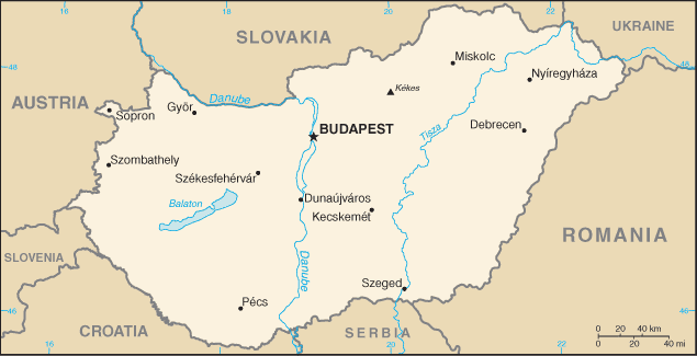
Facts about Hungary
| Administrative divisions: | 19 counties (megyek , singular - megye) , 23 urban counties (singular - megyei varos) , and 1 capital city (fovaros) counties: Bacs-Kiskun , Baranya , Bekes , Borsod-Abauj-Zemplen , Csongrad , Fejer , Gyor-Moson-Sopron , Hajdu-Bihar , Heves , Jasz-Nagykun-Szolnok , Komarom-Esztergom , Nograd , Pest , Somogy , Szabolcs-Szatmar-Bereg , Tolna , Vas , Veszprem , Zala urban counties: Bekescsaba , Debrecen , Dunaujvaros , Eger , Erd , Gyor , Hodmezovasarhely , Kaposvar , Kecskemet , Miskolc , Nagykanizsa , Nyiregyhaza , Pecs , Salgotarjan , Sopron , Szeged , Szekesfehervar , Szekszard , Szolnok , Szombathely , Tatabanya , Veszprem , Zalaegerszeg capital city: Budapest |
| Area: | total: 93 ,030 sq km land: 92 ,340 sq km water: 690 sq km |
| Background: | Hungary became a Christian kingdom in A.D. 1000 and for many centuries served as a bulwark against Ottoman Turkish expansion in Europe. The kingdom eventually became part of the polyglot Austro-Hungarian Empire , which collapsed during World War I. The country fell under Communist rule following World War II. In 1956 , a revolt and an announced withdrawal from the Warsaw Pact were met with a massive military intervention by Moscow. Under the leadership of Janos KADAR in 1968 , Hungary began liberalizing its economy , introducing so-called "Goulash Communism." Hungary held its first multiparty elections in 1990 and initiated a free market economy. It joined NATO in 1999 and the EU in 2004. |
| Flag description: | three equal horizontal bands of red (top) , white , and green |
| Capital: | name: Budapest geographic coordinates: 47 30 N , 19 05 E time difference: UTC+1 (6 hours ahead of Washington , DC during Standard Time) daylight saving time: +1hr , begins last Sunday in March; ends last Sunday in October |
| Climate: | temperate; cold , cloudy , humid winters; warm summers |
| Currency code: | forint (HUF) |
| Ethnic groups: | Hungarian 92.3% , Roma 1.9% , other or unknown 5.8% (2001 census) |
| Geographic coordinates: | 47 00 N , 20 00 E |
| Geography note: | landlocked; strategic location astride main land routes between Western Europe and Balkan Peninsula as well as between Ukraine and Mediterranean basin; the north-south flowing Duna (Danube) and Tisza Rivers divide the country into three large regions |
| Government type: | parliamentary democracy |
| Imports partners: | Germany 26.6% , China 7.8% , Russia 6.9% , Austria 6.1% , Italy 4.5% , Netherlands 4.3% , France 4.3% (2007) |
| Internet country code: | .hu |
| Land boundaries: | 0 km (landlocked) |
| Neighbouring countries: | total: 2 ,185 km border countries: Austria 366 km , Croatia 329 km , Romania 443 km , Serbia 166 km , Slovakia 676 km , Slovenia 102 km , Ukraine 103 km |
| Languages: | Hungarian 93.6% , other or unspecified 6.4% (2001 census) |
| Location: | Central Europe , northwest of Romania |
| Map references: | Europe |
| National holiday: | Saint Stephen's Day , 20 August |
| Nationality: | noun: Hungarian(s) adjective: Hungarian |
| Natural hazards: | |
| Population: | 9 ,930 ,915 (July 2008 est.) |
| Religions: | Roman Catholic 51.9% , Calvinist 15.9% , Lutheran 3% , Greek Catholic 2.6% , other Christian 1% , other or unspecified 11.1% , unaffiliated 14.5% (2001 census) |
| Terrain: | mostly flat to rolling plains; hills and low mountains on the Slovakian border |
| Unemployment rate: | 7.3% (2007 est.) |
Capital of Republic of Hungary
Budapest (click to view Budapest map)
Places in Hungary
Browse the most comprehensive and up-to-date online directory of administrative regions and Street Views in Hungary. Our listings are organized alphabetically, starting from level 1 regions and progressing through to level 2 and eventually level 3 regions, ensuring you can easily navigate and find specific areas of interest.
Baranya County (623 google map locations)
Bekes County (537 google map locations)
Békéscsaba city Google map
Borsod-Abauj Zemplen County (783 google map locations)
Budapest (42 google map locations)
Csongrad County (305 google map locations)
Debrecen (18 google map locations)
Dunaújváros city Google map
Eger city Google map
Fejer County (509 google map locations)
Győr (2 google map locations)
Gyor-Sopron County (424 google map locations)
Hajdu-Bihar County (338 google map locations)
Heves County (291 google map locations)
Hódmezővásárhely city Google map
Kaposvár city Google map
Kecskemét city Google map
Komarom County (262 google map locations)
Miskolc (44 google map locations)
Nograd County (378 google map locations)
Nyíregyháza city Google map
Pécs (26 google map locations)
Pest County (816 google map locations)
Somogy County (680 google map locations)
Sopron city Google map
Szabolcs-Szatmar County (774 google map locations)
Szeged (14 google map locations)
Székesfehérvár city Google map
Szolnok city Google map
Szolnok County (440 google map locations)
Szombathely city Google map
Tatabánya city Google map
Tolna County (412 google map locations)
Vas County (366 google map locations)
Veszprém city Google map
Veszprem County (573 google map locations)
Zala County (625 google map locations)
Zalaegerszeg city Google map
Random cities in Hungary
Budapest, the capital city of Hungary.Dudar
Frankhegy
Vasboldogasszony
Darányitanya
Réhely
Lajvérpuszta
Hét
Kemesmál
Péliföldszentkereszt
Balatonszepezd
Pálháza
Gadács
Czupytelep
Szécsisziget
Recsk
Mamocspuszta
Borhyfelsőtanya
Vasadihegy
Kilimán
Link to Hungary Google Maps page
The map of Hungary has already attracted 12568 views. If you wish to embed our comprehensive Hungary map on your site, we offer an easy solution. This map includes free access to Google Maps, gazetteer search, detailed country and city maps, Street View, and essential facts, all ready to enhance your website. To use it, simply copy and paste the provided HTML code into your webpage's source code. We appreciate every link back to our Maps and Driving Directions. Thank you for your support!
| Text link to: Hungary map and facts page |
This Hungary map is intended solely for informational purposes. No representations or warranties are made concerning its accuracy or reliability. Users assume all risks associated with the use of Google Maps and Google Driving Directions. World Route Planner is not liable for any losses or delays that may occur from using this free Hungary map.